Tuesday, March 29, 2016

William Heise County Park

Our final stop on our little getaway from San Diego was three nights at William Heise County Park. The park sits at 4200 feet in oak and pine forest at the northern edge of the Cuyamaca Mountain Range, just minutes from the quaint, touristy mountain town of Julian. Deer and turkey are frequent park visitors, even on busy weekends.

There are 20 electric-only sites and 37 dry sites that can accommodate up to 40 ft RVs, as well as 42 tent only sites and several cabins for rent. The park is very busy on weekends, and our Easter weekend stay was no exception. There are several miles of trails throughout the park, many of them are rather steep, and we did not encounter too many people on the trails.

The nearby towns, Julian and Wynola, are just an hour from San Diego and are extremely popular for day trippers. In fact, one day Hans' parents and brother and sister-in-law came out for a drive and lunch with us...a perfect way to spend a gorgeous spring day.

Turkey trotting through the middle of the partial hookup sites soon after we arrived.

There's live music on the weekends at Wynola Pizza.
Sara Petite is a well known San Diego musician.

Nearby hiking includes Volcan Mountain Wilderness Preserve, just a few miles from William Heise, offers several miles of trails. At the top, on a clear day, you can see both the desert and the ocean!

Entrance gate at Volcan Mountain.

Looking down on apple orchards and vineyards.
It's the end of March and everything is GREEN!

We look back on our trail snaking across the hill below.
This is looking west...on a clear day we may have been able to see the ocean on the horizon.

Behind us is Anza Borrego desert where we'd just spent nine days.
The high point behind my left shoulder is Whale Peak, which we'd climbed the previous week!

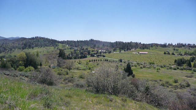
William Heise County Park was one victim of the enormous 2003 Cedar Fire which burned over 280,000 acres, the largest wildfire in California history. In the photo below taken from the parks' Desert View Trail the campground is located in the swath of trees in the center and both the distant and the near hillsides were completely burned away and are now covered with thick chaparral brush.

Both the near and far hillsides were once covered in tall trees and large manzanita bushes.
Today, 13 years after the Cedar Fire, they are covered in chaparral with a few trees trying to make a comeback.
This portion of the Cedar Trail actually goes through the remaining forest.
The Cedar Fire did sweep through here though and thousands of young cedar trees line the trail
promising a lush forest for future generations.
Skeletons of burnt oak trees tower above Hans on the Cedar Trail.
After so much time they are toppling over one by one.

I forgot to take multiple photos of our site at William Heise. In the electric-only section 20 sites are laid out around a circle. Many of them are two or more sites sharing the same parking area...not our cup of tea. Some sites throughout the park are quite unlevel.

We chose site #11, one of the few sites that did not share space, and it turned out to be extremely narrow, just barely fitting our rig and truck, we had no room to spare on either side due to trees and bushes. Thank goodness we only have slides on one side, a rig with opposing slides would not have fit in this site!

Fortunately we had a nice big area behind our site for our sitting area, though it was open to the neighbors so no privacy. There was also access to some wonderful terrain for Rosie to explore. If we stay here again we'd want site #8 or #12 in the electric-only section. There were also some beautiful, large, private sites in the dry section, such as site #22.

Verizon signal is excellent at this park.

That's our Montana jammed into site #11.
Site #12 on the right had a little more room to maneuver.

Six turkeys parading through our sitting area on Easter morning.
Rosie loved exploring among the bushes and trees behind the turkeys.

In kitty heaven!

We are now back in San Diego till mid May for sure. Fingers crossed my mom continues to improve...

Monday, March 28, 2016

Anza Borrego State Park

From Agua Caliente Regional Park to our next stop at Anza Borrego Desert State Park's Palm Canyon Campground was a pretty 45 mile drive through the desert. We chose to stay in one of the full hookup sites at Palm Canyon. These sites had better separation than our last stop but were barely long enough to hold our 35 foot 5th wheel and big truck.

Awesome sunset on our first evening,

And equally beautiful sunrise the next morning!

For our first hike we chose to walk up Palm Canyon right from our campsite. This is a very popular trail, especially in the spring, so we made sure to get out early. We ended up hiking about 5 miles round trip, including at least half a mile past the palm grove where most folks turn around. On our return to the main palm grove we encountered lots of people (midweek) but taking the Alternate Trail back was more solitary and added another perspective to this wonderful hike.


Three lizards enjoying morning sun.


It's a bit of a challenge to scramble beyond the first palm grove,
but what awaits you up canyon is beauty and solitude beyond compare.


I was fortunate to spot this red diamond rattler sun bathing from a good distance.

We were even able to stand on the rock above him for another perspective before he slithered underneath.

Every canyon hike in Anza Borrego requires grippy shoes for lots of rock scrambling!
Poppies and shadows.

Another hike to an oasis near our camp site was Hellhole Canyon. This five mile out-and-back hike ends at a lovely little waterfall alcove full of maidenhair ferns. The scrambling up canyon gets pretty hairy in the last quarter mile or so but the payoff was more water at the fall than we've seen in years past.

Ocotillo blooms are brilliant splashes of color against desert mountains.

Brittlebush provides fantastic color up every canyon we hike.

A couple of warblers enjoy the stream.


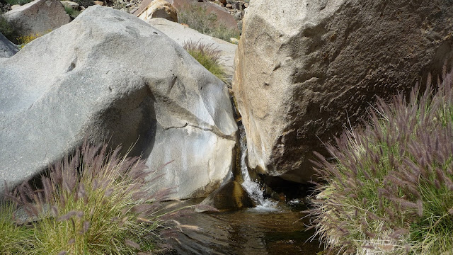
Maidenhair falls...that is a pretty good flow thanks to a decent amount of rain this winter.


Any trip to Borrego Springs should include a tour of Galetta Meadows.

One of many fantastic metal sculptures spread across the desert around Borrego Springs.

Our last hike in this area was supposed to be Pinion Wash to Harper Flat, an area extensively used by Native Americans. We made a wrong turn while driving Pinion Wash and ended up hiking Nolina Wash, one canyon over from our intended goal. No matter...Nolina Wash was lovely and we even found some morteros and another Three-Lined Boa. Harper Flat will be waiting for us the next time we're in this area!

Native American morteros.

Three-Lined Boas (formerly Rosy Boas) are native to a small segment of Southern California.
We've seen three of them in as many weeks!

There was a wonderful variety of rock throughout this wash.

This ended up being our turn around point about 2.5 miles up the wash.
Hans scrambled up the left side of this boulder and said it was getting more difficult up stream.

Carefully maneuvering down the other side.

Anza Borrego's Palm Canyon Campground was a good home base for exploring another section of this huge state park. We chose to stay in the full hookup section and found our pull through site just barely big enough to hold our 35 foot 5th wheel and truck.

Verizon signal was strong but the tower was so overloaded we had frustratingly slow internet access.

Even though the sites at Palm Canyon had better separation than those at Agua Caliente Regional Park, we overall preferred Agua Caliente for its location, variety of trails and hot pools.

Next up: we move on to the mountains for a brief stay before heading back to San Diego.

Friday, March 25, 2016

Adventures in Anza Borrego: Whale Peak and Mud Caves

Our next adventure from our base camp at Agua Caliente Regional Park was a hike to the highest peak in the area. At 5,349 feet Whale Peak offers a tempting respite from the desert heat below. Jerry Schad's excellent book Afoot and Afield in San Diego County offers two approaches to this peak, a 13 mile loop from the desert floor and a 4 mile out-and-back from 4,000 feet.

Hans and I had hiked this peak once before. In 2006 we had an epic 16 mile day on the trail with two of my buddies, Kathryn and Celine. On that day we chose the long West route and, due to the lack of defined trails on this peak lost our way, adding several miles to an already long day.

This time, having a 4WD truck, we decided to do the shorter North approach even though the access road sounded a little gnarly...would we be able to get past The Squeeze??? But, fortuitously, in the pool the evening before we talked to a couple of locals who told us that when we come to the second high point on Pinion Mountain Rd. we should park on the spur road to the right and walk up the ravine where we would find a good trail to the peak. This starting point is located before The Squeeze.

This turned out to be excellent advice. The road was a bit hairy for our big truck, quite narrow and sandy in places. We ended up with a moderately strenuous 5 mile out-and-back hike on a mostly obvious trail. I say mostly because any route to Whale Peak includes finding your way through rocky sections marked with cairns that can be difficult to follow at times. Also, when I saw a photo of The Squeeze later I knew our truck would not have made it through...which would have added four miles to the hike!

We could see Whale Peak from our camp site.
It is the highest point on the left in the distance.

We parked on this little spur road off of Pinion Mountain Rd
opposite a hillside with interesting rocks protruding from the side.

The trail started with a steep rock scramble up a ravine.
Hans, Martin and Chelsea are hanging out on the peak with the valley including our campground in the background.
I even found our entry on the trail register from our 2006 hike!

The next day we explored an area known as the Mud Caves. Less than 10 miles from Agua Caliente Regional Park via decent roads through sand washes, the Mud Caves are located in Arroyo Tapiado and are created by wind and rain erosion of this ancient lake bed.

There are 22 known caves and 9 slots. Some of the caves are hundreds of feet deep and have huge rooms inside. We chose to avoid the caves due to concern over their safety, especially since there has been a fair amount of rain in the desert this year and we saw plenty of signs of sliding mud in the surrounding mud hills. The slot canyons were fun to explore though!

Approaching the mud hills of Arroyo Tapiado.

We walked up three separate canyons and encountered cool arches like this in each one!

The morning shade was welcome as we walked into each slot canyon.


Not many plants were able to take root in this bleak terrain, but amazingly we had spring flowers!


Multiple arches.


After leaving Arroyo Tapiado we made a loop drive on the back roads, coming out through Canyon Sin Nombre.
This beautiful area required 4WD to get through. It's hard to see Hans but he is in front of the truck scouting the route.

Our last morning at Agua Caliente we hiked the Moonlight Canyon trail again...we really enjoyed the variety of short trails available at this county park!

Our second Three-Lined Boa sighting in as many weeks!


All over Anza Borrego the beavertail cacti are just on the verge of an explosion of pink!
Looking down on the campground from Moonlight Trail with the Whale Peak range in the distance.

Campground Review

Agua Caliente Regional Park is about 100 miles east of San Diego in the Anza Borrego desert. It's got 140 campsites, many with full or partial hook ups. There are a few miles of trails at the park, but many miles of exploration is readily available in the surrounding desert.

The park is only open from Labor Day weekend to Memorial Day and it is very popular due to the geothermally heated pools onsite. The three pools range from 83 to 102 degrees and the warmest pool is indoors and adults only. This park can be extremely crowded on the weekends.

Due to the popularity of this park reservations are recommended on the weekends, midweek there were plenty of sites available. We happened to stay here during spring break and the park was 99% full over the weekend and about 25 - 30% full on weekdays.

When we made our original reservations for February we had the enormous site #104, but when we changed our reservations due to family health issues we had fewer sites to choose from and site #99 was pretty tight with barely enough room for our truck and trailer and a tiny sitting area behind the rig. Most sites are pretty close together and some are rather unlevel.

Despite the close sites and weekend crowds, we loved our stay here! Fortunately we only had neighbors over the weekend. The views are spectacular, the pools are nice during the week, the trails are lovely, the wildlife watching was excellent, and the exploring in the surrounding desert is spectacular...oh, and we happened to be here during a good spring bloom!

Verizon signal was nonexistent, except for a few hours each afternoon with our booster.


We had site #99 and you can see that site 100 is close, just a couple of feet up from us.
Also, site 99 had very little space behind it for a sitting area...but the views were good.
Our door side got blasted by the afternoon sun.

Looking at our site from the other direction.

Shuffleboard and horse shoes.

The indoor pool is the hottest at 102 degrees...adults only.
9:30 - 5pm daily, 6pm - 9pm on Friday and Saturday.

There are two outdoor pools and both are all ages.
This is the coolest pool at 83 degrees. The other outdoor pool is about 96 degrees.

One of our favorite sites #96. It sits at the end of the row with nice views and pretty plants.

Site 98 is very narrow just like our site to the left.

Another favorite site is #104. It's at the top of the hill with commanding views, only one neighbor and it's a really big site.

There are several cabins for rent.

Seen from the pool!

Hooded orioles like ocotillo flowers.

Rosie loved this park!
Here she is basking in the sun without a care in the world!

Next up: we move on to Anza Borrego State Park.