Sunday, June 30, 2013

Exploring Lovely Back Country in the Fossil Ridge Wilderness

Our last full day of exploration around Gunnison, CO took us East of town, into the Fossil Ridge Wilderness.    This small wilderness area located within Gunnison National Forest is accessed through the very small hamlet  of Ohio City, a former gold and silver mine town that is little more than a few homes these days. From Ohio City we headed West on Gold Creek Road, passing ancient cabins and mine ruins, to access the Mill Lake Trail. This 5 mile out and back trail took us up through pine and fir forest to pretty little Mill Lake at 11,500 ft.

It had rained here yesterday so the trail was clean and sparkling fresh, with none of the dust that we encountered on trails the day before. Rain was again predicted for the afternoon and we watched the clouds building and moving while we hiked. Streams were plentiful, large and small, sometimes overtaking the trail as the path of least resistance.


My favorite little crowns! Columbine.
Here, the stream took over the trail.
We picked our way through admiring the lush mosses along the way.


Mill Lake...another pretty alpine lake.
Colorado seems to be full of these lovely gems!

Pika hiding in the rocks! Check out that ear!

Cute little bugger!


In an old avalanche zone, this particular young tree was notable for its burgundy cones.

Beautiful!

On the drive back to Ohio City we stopped to check out the old buildings along the way.


Peeking in the windows of this one, it looked like it is still in use.


An old mine mill perhaps?

Tomorrow we move on to Buena Vista, CO where we will settle in for two whole weeks. More adventures to come!

Gorgeous Hiking and Back Roads Near Crested Butte

Temperatures were predicted to climb in the Gunnison Valley where we are staying so we headed North a few miles to check out Crested Butte. This former coal mining town is now an upscale ski town and, on the day we visited, it was a lovely sight to behold: quaint historic buildings surrounded by rolling green hills, bright patches of wildflowers in bloom, with snow-touched mountains near and far.

The drive up was beautiful beyond words.


After a quick stop at the visitor center we hiked the nearby Snodgrass Trail.


After a few miles on the trail, the back country beckoned, it was time for a dirt road drive. We headed up Gothic Road, making a brief stop in Gothic...a former mining boom town, it is now the site of Rocky Mountain Biological Laboratory.

From Gothic we continued North, around Mt Baldy, on to what I believe was Slate River Rd, through the tiny hamlet of Pittsburgh, and back to Crested Butte. This ended up being about 25 miles of dirt road, stream crossings, narrow mountainside sections where we were fortunate not to meet anyone, and astounding beauty.

The East River snakes its way through the valley North of Crested Butte.
Clouds were building all around us as we headed into the back country.


Here the road narrowed dramatically, with a steep drop off on the left.
A small creek almost takes over the road, something we would see often on this drive.

Emerald Lake.
We saw zebra-striped mountains in the distance.

One of several stream crossings.

Natures infinity pool.

Looking back a the valley we'd just ascended.


The road would make its way into the valley below.

The zebra-striped mountain turned out to be a glacier trough up close.

The valley formed by the glacier above.

A last look back at the beautiful country we had driven through.
Beaver dam in foreground.

We took a little walk through downtown Crested Butte, admiring the historic buildings and browsing through some of the stores...the prices were too rich for our pocketbooks though!


During the drive back to Gunnison we admired the puffy clouds over the rolling hillsides.


Taking a short detour through the tiny town of Almont looking for an RV park that never appeared, we spotted some big horn sheep grazing on a hillside.


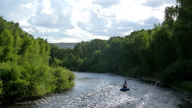
Later, we walked to dinner at Garlic Mikes just down the road from our RV park. The food was good, but not great. We crossed the Gunnison River on the way home and watched paddlers enjoying an evening float and fish.


Another fantastic summer day in Colorado!

Saturday, June 29, 2013

Getting to Know Gunnison

Even though Gunnison, CO sits at the same elevation (7,700 ft) as our last stop, Ouray, CO, the landscape is very different. We went from a town nestled in a canyon, surrounded by tall mountains to a town in a large, open high desert valley. In fact, Gunnison is one of the coldest places in the US during the winter due to its location at the bottom of several valleys where cold air settles.

Summertime temps are quite normal though, and we've been close to 90 degrees for the past couple of days. Oddly enough we are experiencing higher humidity than anywhere we have been since leaving California in January. Perhaps we are starting to get the typical monsoonal weather that hits this part of the country July through August.

We're set up in the Tall Texan RV Park for a few nights and the cottonwoods starting blowing cotton heavily the first day we arrived.

Cotton "snow"!

The next morning we attempted to take a walk by the Gunnison River but the mosquito's were too thick so we diverted to Hartman Rocks. Just South of town, Hartman Rocks is 8,000 acres and over 20 miles of trails for all types of outdoor enthusiasts. Luckily we had slightly overcast skies so we didn't overheat as we scrambled around on these giant granite boulders.

View of the Gunnison Valley from Hartman Rocks.
Some of the trails are steep!


There are miles of boulder outcroppings to explore.


This tree has grown embedded in the rocks.


In the park next to the Gunnison Visitor Center the trunks of dead trees have been carved into some wonderful, detailed sculptures.