Wednesday, March 20, 2013

Land of Standing Up Rocks

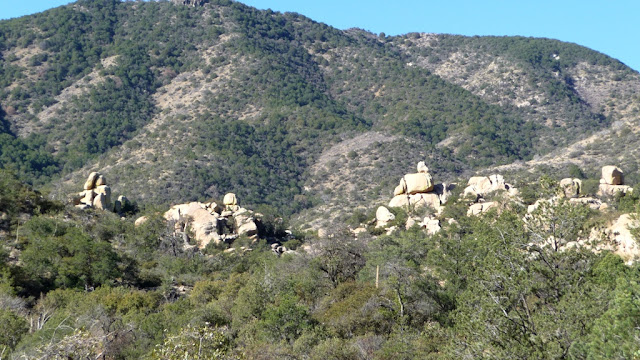
Today's Chiricahua National Monument was once called the "standing up rocks" by the Chiricahua Apache. Formed 27 million years ago by eruptions from the Turkey Creek Volcano, these pinnacles are a wonderland of rocks in South Eastern Arizona.

We took the 8:30am shuttle offered at the visitor center to the end of the road at Massai Point and hiked the 10 mile Big Loop back to our truck. If you plan on doing the same, I recommend you call and get your name on the list for a seat on the shuttle van. They don't mention the shuttle on the website, but they run one or two vans each morning at 8:30 for those who wish to hike the length of the canyon one-way.

For the 10 miles (exactly!) we took Echo Canyon, Hailstone, Mushroom Rock, Big Balanced Rock, Heart of Rocks Loop, Sarah Deming and Lower Rhyolite Canyon trails. If you don't have the time or inclination to do 10 miles, I recommend the Echo Canyon/Hailstone/Ed Riggs loop (just park at the Echo Canyon picnic area, shuttle is not required).

I'll let the pictures tell the story of our wonderous day. If you are ever in this part of the country and you love amazing rock formations, you gotta check it out!

Right from the start we were WOWed!
Rhyolite pinnacles everywhere, tinged with bright green lichen.


This section was called the Grottos. 
At some points the trail continued along the edge of the spires.


Sometimes we were right among all the towering rocks.

Balancing giants were everywhere!

Here, the trail ran below the massive rocks.


Mushroom rock.


A large portion  of the monument land had been ravaged by fire in 2011.
In some areas we could see acres of stumps burned to the ground,
with only the largest tree skeletons still standing.

Dos Cabezas peaks in the distance.
Amazing balancing rocks in the foreground!


Strong guy!


On Lower Rhyolite Canyon trail heading back to the visitor center,
the opposite canyon wall showed multiple layers of pinnacles.


Tuesday, March 19, 2013

Campground Review: Triangle T Historic Guest Ranch, Dragoon, AZ

Dragoon is a tiny town a couple miles off I-10 between Benson and Willcox, AZ. We spent a week at the Triangle T Historic Ranch, which sits half a mile off I-10, on the road to Dragoon, nestled in the giant boulders of Texas Canyon.

The Ranch has a colorful history that includes the likes of Cochise, Japanese diplomats being interred during WWII, movie and television sets and a stopover for many famous folk over the years. The property was featured on Hotel Impossible in 2012.

Besides about a dozen RV sites and additional dry camping sites, the Ranch includes several guest casitas and rooms, a saloon (open Thurs - Sun, w/live music on Sat nights), horseback riding, a pool and hot tub (still winterized during our stay), and a labyrinth. They bill themselves as a retreat and wellness destination, as well as a site for weddings and other events.

All roads and sites are dirt. We had site #6, and I was sure I was told it was "back in the rocks", but it actually was next to a large rock (very cool) but our front door opened onto the main road into the property (dusty!). Though we were close to the freeway, the noise is minimal.

We arrived on a Tuesday and the place was virtually empty and very, very quiet. It felt like boondocking with full hookups! Over the weekend the place got busier with a dual sport motorcycle rally.

We paid $200 for a one week stay. Dry camping is $23/night...rather pricey just to be able to use their restroom/showers. Verizon 3G service was strong and the parks wifi was decent.

I have really mixed feelings about this park. Here are my impressions, good and bad, based on our one week stay:

Pros: Quirky and rustic, this place felt, at times, like boondocking with full hook ups. Fabulous giant boulders on the property that you can walk among and climb on. Some decent walking trails on the 160 acre property. Really wonderful looking dry camping sites that you could get tents or small RV's into. The Ranch is located next door to the Amerind Museum. 15 minutes to Benson for all the services you can't get here. 30 minutes to awesome trails at Cochise Stronghold.

Cons: Trash not picked up from all the nooks and crannies around the place. People haven't pick up after their pets in a long time. Some of the common areas are dilapidated: there is a basketball court/bandstand area that is falling apart and seemingly left to rot right in the middle of the property. No laundry on site. The price is a little high for the location and quality of the park.

A little elbow grease around the property would go a long way towards improving my impression and desire to return. I prefer staying at quirky/rustic places to those that are immaculately groomed and soul-less, but dirty turns me off. I think this park is fine for a one or two night stay, especially mid-week when it is super quiet and relaxed.

Site #6. Picture taken from the main road into the park.
I took this photo from on top of the rock behind our rig.
A row of empty campsites is behind us, a couple more sites are on our right,
and the entry road is on the left.

The Rock Saloon & Grill is built around a giant boulder!
Open Thurs - Sat, with live music, usually country western, on Sat night.

Lots of neat boulders on the property!
This was an awesome dry camping site nestled in the rocks.


Thursday, March 14, 2013

Boulder Day on the Cochise Trail

The Cochise Stronghold lies on the East side of the Dragoon Mountains. It is named after Chiricahua Apache Chief, Cochise, whose people lived in this rugged natural fortress for 15 years during the mid-1850's. This section of the Dragoon Mountain range is distinguished by pinnacles and giant outcroppings of granite boulders.

We hiked the Cochise Trail, which begins at the small NFS campground at the Cochise Stronghold. This pretty little campground has 9 camp sites recommended for rigs under 30'. 

The Cochise trail can be up to 10 miles round trip; we hiked to the Stronghold Divide which separates the East and West portions of the trail, for a round trip of 7.5 miles total. The trail ascends gently to the divide through oak and manzanita canyons along occasional streams (at this time of year), opening into broad vistas of giant granite boulders. 

On the road approaching the Cochise Stronghold.

The campground is nestled in the trees at the bottom of the photo,
and is surrounded by hills and mountains on three sides.
These granite boulders are part of your morning view.

Heading away from the campground, we were soon treated to views of giant boulders beyond the oak trees.
The faint green tinge on the rocks on the left is lichens.
Many of the rocks in today's pics are covered with bright green lichens.

Gentle ascent among trees.
About 1/3 of the hike was shaded, good news on a day heading into the 80's.

I just love the natural balancing act!

Here you can see the surrounding hills we are walking through are chaparral covered.
The granite boulders are a small section of the Dragoon range.

We get such a kick out of groups of lizards sunning themselves in the morning!

You can really see the green lichens on the rocks here.


Halfmoon Tank, a watering hole about 2 miles in.


This was a gorgeous hike on a well marked, gently ascending trail, with fabulous views, a little bit of water, and some shade...smack  in the middle of a rather dry and barren desert. We may just have to hike the West side of the Divide before we leave the area next week!

Tuesday, March 12, 2013

Campground Review: Patagonia Lake State Park

Patagonia Lake State Park sits just South of the small town of Patagonia, AZ. This man-made lake supports camping, picnicing, fishing, boating, hiking, birding and equestrians. It is adjacent to the Sonoita Creek State Natural Area for access to hiking trails. Permits are required to hike in the Natural Area and can be obtained from the visitor center or the check in gate.

There are 105 developed campsites with a picnic table and fire ring, water and electric. There are also 12 boat-in campsites. Roads and sites are paved. Amenities include a small market, visitor center, boat marina, restrooms with showers and a dump station. Birding and boat tours are scheduled regularly.

We chose site 5, a pull through site, and were surprised to find a very unlevel site! It sure didn't look like it in the picture during reservation! There are three pull through sites next to each other on a small hillside. The other two sites, #3 and #4, are even more unlevel than ours. Despite the challenges of getting set up in this site, it was an excellent location, allowing privacy and great views of the lake and surrounding hills; quite possibly the best site in the campground.

We put out bird feeders during our stay and had the most abundance and variety of birds we have ever seen at feeders, including Northern Cardinals, Pyrrhuloxia, Curved Bill Thrashers, Red Winged Blackbirds, as well as the usual assortment of finches and sparrows.

We had a weak 4G signal using our booster set up (Wilson Sleek 4GV and trucker antenna) and had better luck switching over to 3G only for higher signal strength. A camphost told us the park will be putting in wifi in the future.

We booked our site a couple of months ago. During our stay the park was almost full of reserved sites, and the few vacancies filled up each night. Spring Break had started by the end of our stay, making for more families and college students staying here. We were told this park is party central during the summer.

This is a lovely park and if we are in the area again we will stay here again. We went on both the birding boat tour and a birding walk and both were guided by very experienced birders. We enjoyed the local hiking and the cute town of Patagonia.


Pull through site #5. The top here is the most level part of the site,
though even this part is sloping back and slightly to the left.
That's an access road on the right.
If we had slides on both sides this site may not have worked for us.

View of our site from site 4 below.

View of the back side of our pull through site.
You can see sites 4 and 3 beyond ours, the main campground road is on the right.

View of our sitting area. Site 4 is visible below us.

This is the view from site 5 of the lake and surrounding hills.


Sunday, March 10, 2013

Patagonia Pleasures

We had our first travel day with weather on Friday as we moved to Patagonia Lake State Park. The rain stopped though, once we arrived at our site and got set up in what turned out to be a very unlevel site. But the set up was worth the trouble because we have a fantastic view and sitting area, decent privacy, with loads of birds visiting our feeder.

View from our site #5 which is situated up a slight hill for a view of the lake.

Hans had scoped out the happenings in the little town of Patagonia, just North of the State Park and on Friday night we went to the local theater to catch the wonderful Conjunto Royal. They played a wide variety of Latin music and we thoroughly enjoyed them.

Patagonia Lake State Park is known as a birding destination and on Saturday we went in search of the elusive and much sought after Elegant Trogon. While we were unsuccessful on that count, we did see this cute little guy:


Saturday night we had a good visit and dinner with Hans' cousin Linde and Nandor at Patagonia's Velvet Elvis restaurant. They drove over from Sierra Vista to check out our home on wheels. It's so good to be able to meet up with friends and family all over the country!

This morning we took a birding boat tour of the East part of the lake which is offered each weekend throughout the winter season.

Neotropic and Double Crested Cormorants.
You can see some of the water front camp sites in the background.

Later we met up once again with our friends from British Columbia, Joanne & Don and Steve & Carla, for more hiking, this time at  Sonoita Creek State Natural Area. The Natural Area is just half a mile outside the State Park entrance and you must have a permit (available from the State Park kiosk or visitor center) to hike there.

We did a 5 mile figure eight loop that took us through Sonoita Creek bed and the surrounding hillsides. This part of Southern AZ is at about 4,000 feet elevation so it is just barely starting to green up.

Early on the trail we came across this little slot canyon. 

We walked among rolling grass, yucca and mesquite covered hills. Lots of pretty clouds today as the latest storm fades away.


At one point we were excited to spot several javelina's traveling across a the next hillside over! Too far and too active to get a picture with my little point and shoot.

This was an unusual cactus...I don't know what it is, but I liked the symmetry and colors.

We were a colorful group today!
Steve, I'm sorry your face was hidden!

When we drove past Tubac on Friday we noticed that the Cottonwoods had suddenly turned green, but at Patagonia they were still in their winter coats. Today random Cottonwoods stood out in spring green:


The last leg of the trail passed the West end of Patagoina Lake where we encountered some of the locals whose land we had been sharing all day.


This evening we had the great pleasure of meeting fellow bloggers Rick and JoAnne after they pulled in to stay for a few days. We met them thanks to a tip from Dave and Sue, who also happened to pull in to the campground today!

Today was our six month full time RVing anniversary! So far, so good...I think we'll continue for a while!  :-)

Friday, March 8, 2013

Campground Review: De Anza RV Resort, Amado, AZ

De Anza RV Resort started out as a Greyhound Race Track in 1963. In 2001 it became an RV park.

Currently there are about 130 full hook up RV sites, with another 60 sites planned for development. Roads are paved and sites are gravel and decently sized, with a picnic table. About 15 sites are pull throughs.

All of the park amenities are housed in the former race track buildings. Amenities include laundry, dog wash, library/lounge, salt water pool and spa, fitness room, crafts/sewing rooms, billiards, work shop, huge game room area with darts/shuffle board/air hockey/and more, restaurant/bar and meeting rooms, outdoor fire pit.

The park is focused on providing a welcoming experience for all and really works to keep their long term guests happy and involved with many activities available each week. On Friday nights (the day we happened to arrive) they offered free margaritas, a reasonable-cost dinner (with many choices), plus a live band that was a lot of fun. There was a good turnout for the evening, and it looked like the folks staying for the season really liked staying at this park. They offer dinner on Friday and Saturday nights and breakfast on Saturday and Sunday.

The first two sections of sites, those closest to the entrance of the park and the freeway, have RV sites that back up to a row of trees. The rest of the sites are pretty drab, no plants or anything to relieve the monotony of the gravel, but the grounds around the main buildings are nice and well maintained. All of the staff we met was very friendly and outgoing.

The park is not far from the freeway so you do hear road noise at night as well as occasional train whistles.

Despite the lack of ambiance at our site, it was a pretty nice park. The facilities and amenities were numerous and well maintained. We enjoyed the Friday night activities we attended and the staff was gracious and friendly. Not sure if we would stay here again though, since we may have exhausted all of the sights to see in the immediate area and it's a pretty long drive to our favorite activity: hiking.

Our site, #100. Back in site in the newer section.

Front of the building that holds the office, clubhouse, restaurant, pool, laundry, etc. etc. etc.
Fire pit out front. Garage for storing motorcycles and a workshop in the yellow building.

View of the sites that back up to a row of trees

Pull through sites.

Sites with an East facing sitting area have a great view of the Santa Rita Mountains.
The pointy one in the back is Mt Wrightman.