Tuesday, April 11, 2017

Revisiting a Favorite Town: Prescott, AZ

We last visited Prescott, AZ in April 2014, stayed for a week and fell in love with the town and the surrounding area. We just finished up another week long stay at the wonderfully situated Point of Rocks RV Park, and still find ourselves enchanted with the area.

The afternoon of our arrival we watched a storm roll in from the boulders behind our RV.

We love that Prescott has built over 70 miles of trails within the city limits and continues to build more, even updating their trail map annually. Beyond the town, there are many miles of forest service trails as well. We did a little hiking on the Thumb Butte trails one day, where acorn woodpeckers were the critter of the day.


We revisited the Little Granite Mountain Loop that we hiked three years ago. This is about an eight mile loop that goes through a lovely riparian forest, then several miles through terrain burned in 2013, with quite a lot of steep up and down sections...it's a good workout!

Skeletons of giant old alligator junipers and pinion pines dot the burnt landscape.

At our high point we had expansive long distance views, the snow capped San Francisco Peaks are just visible on the left.

A relatively easy hike is Salida Gulch Trail. This 4.2 mile loop took us up a chaparral covered hillside then down into a gulch with a seasonal stream that actually had water in it due to the extra wet winter the west has experienced. The petroglyphs below were a surprise find as none of the literature mentioned them.

Petroglyphs in Salida Gulch.

The Constellation Trails were a new find on this visit. This area only has about three miles of trails, but still packs in a lot of beauty in the fabulous Granite Dells, It is even possible to add on mileage by taking an unmarked social trail that connects to the Wilson Lake trails.

Imposing granite wall on the Constellation Trails.

We've never seen hedgehog cactus with bite marks before!

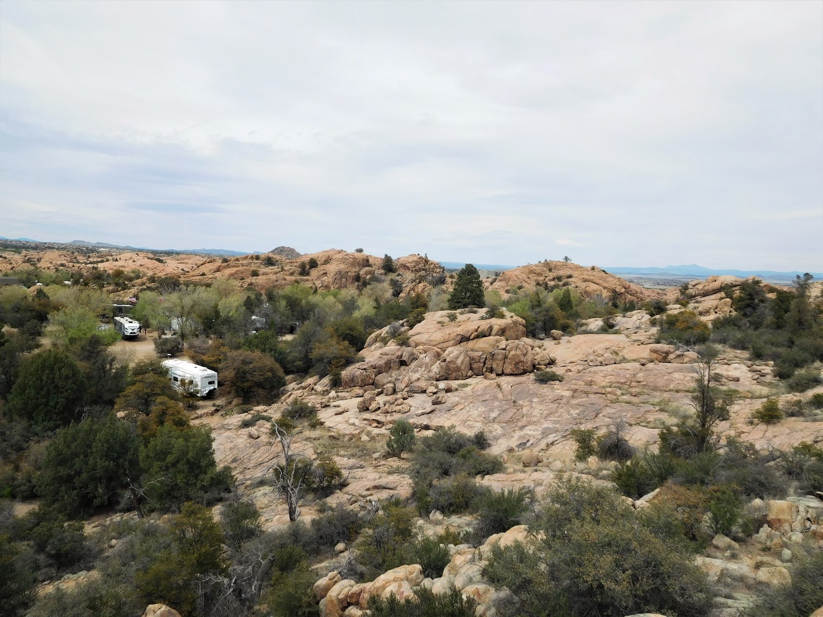
The reason we enjoy staying at Point of Rocks RV Park is the location...it backs right up to the Granite Dells and it is possible to hike all the way around Watson Lake from the RV park, about 5.5 miles round trip. We managed to book our favorite site (#66) which has incredible privacy and easy access to the boulders.

That's our RV backed up to the rocks.

Rosie liked staying here last time, but this time she was nervous all week.
Perhaps there were a lot of scary critter smells.

Hans shadow dancing on the rocks.


View of Watson Lake from the top of the boulders behind our site.

You can even see the San Francisco Peaks in the distance across the Granite Dells.

Of course one day we had to hike around Watson Lake!

Much of the trail crosses the granite boulders...follow the white dots!

Due to the wet winter the lake was completely full and flowing over the spillway.
This is the creek as it flows below the dam.

The spillway.

Hiking through the Granite Dells fantasy land!


Lots of creeks flowing this year as we went around the lake.

Neighboring Willow Lake cannot be circumvented when it is full (without going on city streets), so we contented ourselves with a short stroll along the flat southern end one morning. On our last visit I really enjoyed walking under the cormorant rookery located in a large, dense cottonwood grove on the west side of Willow Lake.This year, the only access to the rookery would be by boat!

Full to the brim Willow Lake.

Willow Lake reflections.

Mural in downtown Prescott.

Prescott remains a favorite stop for us. The miles of trails plus great shopping (Trader Joe's, Costco, and now Sprouts too!) means we'll be back next year for a longer stay.

We've since moved on to Kingman, AZ for a few days...more posts to come!


Tuesday, April 4, 2017

Cottonwood, AZ: Yet Another Gateway to Red Rock Country!

From Camp Verde on the east side of the Verde Valley, we moved just 15 miles west to Dead Horse Ranch State Park in Cottonwood AZ. Cottonwood is about 15 miles south of Sedona, making it the perfect base to explore west Sedona.

We spent a month in Cottonwood in the spring of 2014 and Loved every minute we spent exploring the miles of trails in Red Rock Country (blog posts here). This latest stay was no exception...11 days of hiking, biking bliss! We made an effort to hike some new-to-us trails and to avoid the crowds, not always easy to do in Sedona...starting early (no later than 9am) makes a huge difference.

First up: Long Canyon, trail #122. This lovely, seven mile, out and back hike goes up a forested canyon at a gentle incline with occasional views of the surrounding colorful sandstone canyon walls. This is a great hike for a warm day, the forest is a shady haven and there's supposed to be some ruins and pictographs at the end of the canyon. We searched a little bit but never found them, the forest is quite dense at the head of the canyon.

A vibrant Sedona day in Long Canyon!


Next we hiked Loy Canyon, trail #5. Another gentle incline up a forested canyon for 3.5 miles, the trail ultimately climbs up to the Mogollon Rim and connects to a network of wilderness trails excellent for backpacking. We simply did about seven miles out and back. This time we were fortunate to see a couple of ruins high on the canyon walls above us.

Early in the hike Hans spotted this large set of ruins under a deep overhang.

Some day I'd like to figure out how to get up there!

Later I spotted a small ruin high above us.

One small wall just visible on a small shelf.

Dead Horse Ranch State Park has many miles of trails, both along the Verde River and in the limestone hills that make up much of the park. We biked 12 miles of limestone shelf trails one day and decided it was way too rocky for our tastes! We really enjoyed hiking these trails though.

Tuzigoot National monument can be seen from Tavasci Marsh.

Tavasci Marsh, probably good birding at certain times of the year.

We took the bikes up to Sedona one day, parked along Dry Creek Rd and took off for a twelve mile loop. Chuckwagon trail turned out to be a pretty intense ride for me, but many of the other trails we road in the area adjacent to Dry Creek and Boynton Pass roads were relatively smooth, flowing single track that were fun to ride.

Long distance views from a nice, smooth portion of Chuckwagon trail.

Can't get enough of the colorful views in Sedona!

Creek crossing on Arizona Cypress trail.

We hiked an awesome eight mile loop around Cathedral Rock, with some of the best views we've seen in Sedona. We parked at Yavapai Vista trailhead and took Slim Shady, Templeton, Baldwin, and Hiline trails. Hiline is an intense double black diamond mountain bike trail ridden east to west, so we hiked our loop counter clockwise so we'd see the bikes coming at us.

Cathedral Rock looms over Templeton trail.

Hans at the top of a steep section of Hiline...bikes would fly down this!

Hans watches a bike negotiate one of the gnarly sections of Hiline.

Approaching the top of Hiline the views just get better and better.

Can't get enough of these colors!
Fulltime RVing friend Donna was in town for a girlfriend vacation with her buddy Lynne so we met up one day. Once again parking along Dry Creek Rd we made a great six mile loop following by a delicious lunch at Cafe Paleo Brio in Sedona.

Cloudy and cool along the Ariizon Cypress trail.

I love how the sun comes out of the clouds and colors explode across the horizon!

Happy hikers!

Our final hike was a repeat of a favorite, the Brins Mesa Loop. We parked at Soldiers Pass TH, then took Soldiers Pass to Brins Mesa to Cibola Pass to Jordan trail. Throw in a javelina sighting and an hour of solitude when we took the social trail to the top of Brins Mesa and this was a fabulous seven mile hike!

It adds about a mile to the loop hike, but taking the spur trail to the top of Brins Mesa is worth the effort!

Scotts Oriole.

Exquisite views from Cibola Pass.

So ends another amazing stay in the Verde Valley, I don't think we'll ever get tired of Red Rock Country...

Tuesday, March 28, 2017

Camp Verde, Gateway to Red Rock Country

From the Phoenix area we headed north about 75 miles to Camp Verde, AZ, southern gateway to Sedona and its miles of hiking and biking trails among fabulous rock formations.

We spent a week at Rancho Verde RV Park, a pretty, green and quiet small park that we've stayed at previously. It's a great place to access the east side of Sedona plus the many Native American historical sites that dot the Verde Valley. The only drawback to this RV park is the slow Verizon signal and spotty park wifi.

We discovered the MacDonald trail, a short but strenuous climb to the Camp Verde Cliff Dwellings. This is a fun place to explore...there are obvious dwellings in the face of the cliff as well as ruins from a large pueblo on top of the mesa to the west. Pottery shards are visible everywhere.

The final steep ascent to the cliff dwellings.

This is the most obvious cliff enclosure, but many more alcoves are scattered along the cliff face.

Heading west from the alcove above, we found a precarious route up onto the mesa top.
Continuing west atop the saddle we came upon extensive rock walls of a former pueblo.

The red bits are just a tiny sampling of the millions of pottery shards we saw everywhere.

Exploring additional alcoves in the cliff face...they are on multiple levels.

This large alcove had several additional holes (storage?, sleeping quarters?) dug into the walls.

We hiked Woods Canyon, a favorite, lightly traveled trail on the south east edge of Sedona's red rock country. We last hiked it in March 2014 and didn't see any water in Dry Beaver Creek until a few miles into the hike. This year the abundant rains have Dry Beaver Creek flowing fast for miles!

Heading into Woods Canyon.

Dry Beaver Creek flowing heavy!

Here's what the creek looked like in March 2014...a lot closer to it's name "Dry Beaver Creek"!

No stay in the Verde Valley would be complete without a weekend trip up to Jerome...live music every weekend afternoon at the Spirit Room!

Cadillac Angels at the Spirit Room.

We hiked another favorite in the area, the Bell Trail, which follows Wet Beaver Creek for several miles. It's an eight mile out and back to The Crack, a neat geologic feature along Wet Beaver Creek.

The Crack,

Lovely views along Bell Trail.

We did a little hiking near the Village of Oak Creek, parking at the Bell Rock Vista parking lot and making a 7.5 mile loop including a trail that shows up on Google Maps but not on any of the official Sedona trail maps. This unnamed trail took us up on a mesa overlooking Jack's Canyon, and though it looks well used, we did not see another soul until we returned to the regular trails...gotta love solitude when you can find it around busy Sedona!

View of Courthouse Butte from the unnamed trail. 

Just another typically fabulous Sedona view!

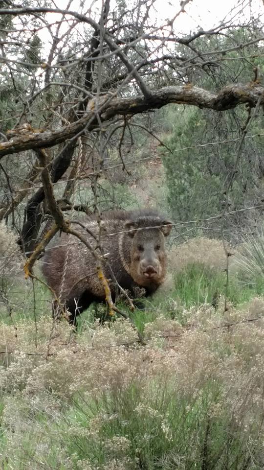
Hans spotted this big Javelina and a few of his friends near Oak Creek.

We've since moved on to Dead Horse Ranch State Park just up the road in Cottonwood, AZ. More adventures from one of our favorite parts of the country coming up soon!