Sunday, August 30, 2015

Hiking from the Scenic Beartooth Highway

Walking through the RV park in Desert Hot Springs last fall we happened to stop to chat with a couple who hailed from Red Lodge, MT before they hit the road. When they learned we loved to hike and would be going to Montana in the coming summer, they enthusiastically described their small home town and the wealth of trails surrounding it. A little bit of research later and we knew Red Lodge would be a perfect stop during our summer travels...gotta love those chance meetings on the road!

Nestled up against the Beartooth Mountains and positioned at the north east end of the Beartooth Highway, Red Lodge is perfectly situated for maximum outdoor activities...exactly our kind of place. For our first outing in the area we chose to drive a portion of the famous highway.

The 68 mile long Beartooth Highway winds its way along the Beartooth-Absaroka Wilderness, climbing thousands of feet to its high point of 10,947, offering up views of 12,000 foot peaks, numerous glacial lakes and alpine tundra plateaus, all between Red Lodge and the north east entrance of Yellowstone National Park.

We only drove about half of this scenic beauty but we were WOWed by every single mile! Smoke haze dimmed the view a bit but could not suppress our wonder and amazement of another of our country's incredible mountain ranges.

We saw lots of marmots on this day...we just love these photogenic critters!

Near the high point of the Beartooth Highway tiered lakes dropped away into deep canyons while snow dotted mountains stretched away as far as the eye could see (through the smoke haze).

Much of the near view at the top of the east portion of the highway is of tundra covered plateaus

The long sliver of Gardiner Lake is a popular trailhead into the Beartooth Mountains.

The Beartooth Highway snakes its way into the wilderness.
Our stopping point on this day will be the second lake pictured above.

A pullout alongside Long Lake gives access to the Hauser Lake trailhead, our hike for the day. This trailhead is one of three access points to the Beartooth Loop National Recreation Trail, a hike which would be a minimum of 12 miles including the access trail (I found plenty of conflicting information about this trail and its access points).

We chose to hike about seven miles out and back, and what a beautiful seven miles it was! Gentle rolling hills starting at about 9,500 feet elevation led us to three lakes (Hauser, Losekamp and Stockade) with views of pointy peaks, across meadows dotted with kettle ponds, alongside babbling streams with sweet waterfalls. We were on constant lookout for moose, elk and bears (this is grizzly country), though we did not see any large mammals on this day. Bear spray is a necessity in this country.

We parked overlooking pretty Long Lake. 

Less than a mile from the road is pretty Hauser Lake.

And another cute marmot sighting!

Crossing a late summer golden meadow.

Losekamp Lake.

The stream between Losekamp and Stockade Lakes was extremely picturesque. 

We could not get enough of this lovely stream...every angle was pleasing.

Stockade Lake.

The same stream as it drops into Stockade Lake.


As we made our way back to the trailhead the clouds were building.

Even under grey skies the meadows and kettle ponds are enchanting.

And we finish our hike with one last sighting of the mammal of the day!

As you can see unsurpassed beauty awaits you on the Beartooth Highway...and we only drove half of it!

Sunday, August 23, 2015

Taking Care of Business in Billings, MT

We've spent the past week in Billings, MT catching up on some big city shopping and taking care of minor RV repairs. Fortunately we only had two days of smoke haze from fires in the west so we were able to get out on the local trails.

80 million years ago the Billings area was the shore of the Western Interior Seaway. The sand deposited by that sea is now evident in the rimrock sandstone formations that border the metro area. Many of the local trail systems are located on the sandstone ledges overlooking town, offering up terrific views of the area. The Yellowstone River runs through Billings and several trails can be found along its forested banks.

Links to local trails:
Four Dances Natural Area
Soft Surface Trails
Hard Surface Trails

Cute payload seen on the road to Billings.

Yellowstone River overview from Four Dances Natural Area.

Sandstone bluffs at Four Dances Natural Area.

Checking out the Yellowstone River.


Swords Rimrock Park.

Montana beauty from Zimmerman Park trails.

There are a couple of disc golf courses in Billings. We played the easy nine holes at Pioneer Park on a smokey day, but the Diamonx X course at Phipps Park is supposed to be extremely challenging.

Fun and easy disc golf at Pioneer Park.

We were thrilled to discover Billings has the best farmers market we've seen in months. Held on Saturday mornings, this is a true farmers market...there are no crafts, only produce, homemade edibles, meats and eggs, and ready-to-eat foods. It's big, about six blocks of vendors, and the prices and quality were excellent.

There were several Hutterite Colony farms in attendance, with large spreads of gorgeous produce.

We stayed at Billings Village RV Park. Roads and sites are paved with nice grass between sites. Sites are quite close together, but staggered for maximum separation possible. Verizon signal was decent. There are a couple of clothes lines so you can air dry your laundry, always appreciated! There is some train and road noise. The park is convenient to everything Billings has to offer.

Today we've relocated to Red Lodge, MT and we're ready to explore the Beartooth Mountains, home of the highest peak in Montana!

Sunday, August 16, 2015

We Saved the Best for Last: Lost Twin Lakes

Our month in Buffalo, WY is drawing to a close and we find ourselves thoroughly enchanted with this state. It happens to be the least populated of all the states, leaving lots of wide open country to explore. While the western half of the state is known for its mountains, the east is typified by high plains. Buffalo put us right on the edge where those two ecosystems meet.

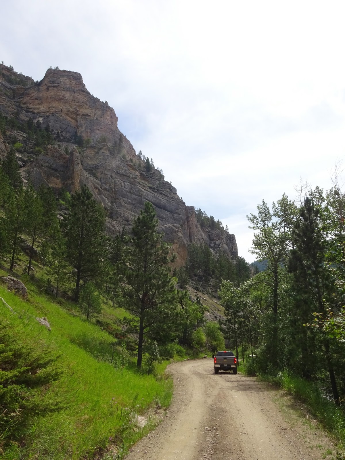
For our last hike in the Bighorn Mountains we drove about 55 miles to the west side of the range and the Ten Sleep trailhead. Ten Sleep Canyon and Creek got its name from an old Indian encampment that was "ten sleeps" from important points such as Yellowstone and Fort Laramie.

The 11 mile round trip (out and back) hike to Lost Twin Lakes starts out at 9,250 feet and tops out at about 10,500 feet, making this destination the highest point we've reached in the Bighorns. The trail has a few steep sections, always a bit of a challenge at this elevation, but the scenery is worth every single step. As you'll see, the colors on this day were vibrant (my photos are untouched). Even though after a month in the area we are ready to move on, a day on the trail like this one makes us appreciate the intense beauty of our country and the immense freedom we have to enjoy it in this singular lifestyle we live.

The first couple of miles climb through forest broken up by a couple of lovely stream crossings. 

Breaking out of the forest and leveling off a bit, we came to a meadow of astounding beauty.

We took a short detour to Mirror Lake, while not being very mirror-like at the moment,
was still quite a sight to behold.

We continued on, encountering more colorful, serene beauty every step of the way.

The rocky, rounded peaks of the Bighorns began to unfold ahead of us.

A fly fisherman casts his line in this pristine creek.

About four miles in we started to see the sheer cliffs that surround our destination...

As we drew nearer granite boulders and slabs dotted lush green meadows
and the cliffs grew more imposing with each step.


Lost Twin Lakes in all their glory!
There is a second lake just visible above the one in the foreground.


Looking back at the last valley we ascended.


As we made our way back the way we came the sun lit up our favorite meadow with such perfection
that more photos were required.


Buffalo has been a wonderful place to spend a month. It's got small town charm, the locals have been friendly and the proximity to the mountains ideal. Deer Park RV Park worked out perfectly for us, it's pretty and clean, the sites are large, park wifi is decent and Verizon signal is excellent. Even though we're right on the edge of town and about a quarter mile from I-90, it was pretty quiet and we even had good wildlife viewing from our site.

Today we head into Montana for a few weeks, but we're not done with Wyoming yet for this year...we'll be back to explore the western half of the state soon.

The Buffalo, WY cemetery is a pretty place to walk and even offers wildlife viewing!


Thursday, August 13, 2015

Day Trips From Buffalo, WY: Crazy Woman Canyon

Crazy Woman Canyon is a popular 40 mile scenic loop, or auto hike ;-) from Buffalo, WY. RV's and other large profile vehicles are NOT recommended. A high clearance vehicle is a wise choice, we encountered one spot with some pretty deep ruts and drops, though we did not need 4WD. There are a number of small, beautiful forested tent areas.

There are conflicting stories about how the canyon got its name. One says an Indian woman was left to live alone in her tipi and she went crazy. Another is a gruesome story of a settler who saw the capture and scalping of her husband by Indians and she lost her mind.

For centuries this canyon was used as a passageway for Native Americans and was a staging area for war parties during the Plains Indian Wars. Today it is a gorgeous trip through some of the most stunning scenery in the area.

As we dropped into Crazy Woman Canyon the forest was lush, the canyon walls erupting sandstone spires.

Lovely Crazy Woman Creek.

I could sit here for hours.

Aspen and pine lined the road as the sandstone canyon walls closed in on us.
Imagine October.


Boulders as large as RV's littered the hillside.


Check out the size of the boulder on the left!


Mosses and other small plants carpeted the rocks at the water line.


At one point the entire creek dropped into the hole below Hans and went underground for a tenth of a mile!

These Common Mullein blooms always make me think of popcorn!

Near the end of the canyon the walls were red sandstone.

Exiting the canyon we looked back to a wall of triangular sandstone slabs.

The mountains immediately give way to rolling, grass covered plains.

Pronghorn dot the plains all over Wyoming.

Clouds build over the Bighorn Mountains.
Crazy Woman Canyon is up the V...

Another typical Wyoming scene...cattle is big business here!

The mountains, the plains and the big, beautiful skies are quintessential Wyoming.

Grazing lands are still quite green from all the rain this spring and early summer.

I love this country!

Every irrigated field we pass has either pronghorn or deer munching happily.
This time I was thrilled to have a pair of youngsters close enough for a photo.


I find them sweet as can be...don't know what the ranchers think of them though!