Tuesday, March 28, 2017

Camp Verde, Gateway to Red Rock Country

From the Phoenix area we headed north about 75 miles to Camp Verde, AZ, southern gateway to Sedona and its miles of hiking and biking trails among fabulous rock formations.

We spent a week at Rancho Verde RV Park, a pretty, green and quiet small park that we've stayed at previously. It's a great place to access the east side of Sedona plus the many Native American historical sites that dot the Verde Valley. The only drawback to this RV park is the slow Verizon signal and spotty park wifi.

We discovered the MacDonald trail, a short but strenuous climb to the Camp Verde Cliff Dwellings. This is a fun place to explore...there are obvious dwellings in the face of the cliff as well as ruins from a large pueblo on top of the mesa to the west. Pottery shards are visible everywhere.

The final steep ascent to the cliff dwellings.

This is the most obvious cliff enclosure, but many more alcoves are scattered along the cliff face.

Heading west from the alcove above, we found a precarious route up onto the mesa top.
Continuing west atop the saddle we came upon extensive rock walls of a former pueblo.

The red bits are just a tiny sampling of the millions of pottery shards we saw everywhere.

Exploring additional alcoves in the cliff face...they are on multiple levels.

This large alcove had several additional holes (storage?, sleeping quarters?) dug into the walls.

We hiked Woods Canyon, a favorite, lightly traveled trail on the south east edge of Sedona's red rock country. We last hiked it in March 2014 and didn't see any water in Dry Beaver Creek until a few miles into the hike. This year the abundant rains have Dry Beaver Creek flowing fast for miles!

Heading into Woods Canyon.

Dry Beaver Creek flowing heavy!

Here's what the creek looked like in March 2014...a lot closer to it's name "Dry Beaver Creek"!

No stay in the Verde Valley would be complete without a weekend trip up to Jerome...live music every weekend afternoon at the Spirit Room!

Cadillac Angels at the Spirit Room.

We hiked another favorite in the area, the Bell Trail, which follows Wet Beaver Creek for several miles. It's an eight mile out and back to The Crack, a neat geologic feature along Wet Beaver Creek.

The Crack,

Lovely views along Bell Trail.

We did a little hiking near the Village of Oak Creek, parking at the Bell Rock Vista parking lot and making a 7.5 mile loop including a trail that shows up on Google Maps but not on any of the official Sedona trail maps. This unnamed trail took us up on a mesa overlooking Jack's Canyon, and though it looks well used, we did not see another soul until we returned to the regular trails...gotta love solitude when you can find it around busy Sedona!

View of Courthouse Butte from the unnamed trail. 

Just another typically fabulous Sedona view!

Hans spotted this big Javelina and a few of his friends near Oak Creek.

We've since moved on to Dead Horse Ranch State Park just up the road in Cottonwood, AZ. More adventures from one of our favorite parts of the country coming up soon!

Wednesday, March 15, 2017

A Couple of Weeks on the Outskirts of Phoenix

We've spent the last two weeks hopping between some of the very nice parks surrounding the Phoenix metropolitan area. First stop, five nights at Lost Dutchman State Park, where we last stayed in March 2014. This time we just hiked some trails in the park (though not the intense Flat Iron trail), met up with some friends staying nearby, and spent some time with my dad who was passing through the area.

Hans, Lisa's dad Ron and Cookie overlooking Canyon Lake in the Superstition Mountains.
Harris Hawk.

Sunset at Lost Dutchman State Park.

On the feeder at Lost Dutchman State Park.

Our next stop was an old favorite, McDowell Mountain Regional Park. We first stayed here in November 2012 and discovered the amazing network of fun and not-too-hard mountain bike trails at this park. Hans managed to ride over 60 miles during our 5 night stay, I rode about 30 and we both enjoyed every minute of it!

New to us this time was adding some of the trails from the adjacent McDowell Sonoran Preserve to our rides. The Goosenecks and Saguaro Nest trails were fantastic flowing fun that should be on every mountain bikers list! We also enjoyed watching some great riders on the Cactus Cup 40 mile race held the weekend of our stay.

We love, love, love the sites at this park. Huge separation and amazing views. We loved site 62 last time and we loved site 56 this time. Even though 56 is an interior site, there are no close neighbors, views are wonderful, restroom is nearby and we had shade all afternoon...important as the temps edged into the 80's.

Sunrise at site #56, McDowell Mountain Regional Park.

Ragged.

Several hundred riders did the Cactus Cup 20 and 40 mile races at McDowell Mountain Regional Park.
Here we catch a little action on the race course!


Crested saguaro beauty at McDowell Mountain Regional park.

Our third stop outside of Phoenix was Cave Creek Regional Park. We last stayed here in March 2014 and had a site that was pretty and spacious but our patio area baked under the hot sun all day long. This time we got smart and booked the lovely site #8, with all day shade and views and privacy galore. We really hit the jackpot with spring flowers on all our hikes in this area.

Sunset at site #8, Cave Creek Regional Park.

Morning ascension seen from the Go John Trail.

It's the perfect time to stay at Cave Creek Regional Park!


Excellent bird activity around our site at Cave Creek Regional Park.


Is there room for me?

We once again hiked the fabulous eight mile lollipop loop at Spur Cross Ranch Conservation Area, following Dragonfly, Tortuga, Elephant Mountain and Spur Cross Trails. We also spotted our first rattler of the season...Hans would have walked right past him if he hadn't let us know he was watching!

Cave Creek.

Petroglyph and a view from the Dragonfly trail.

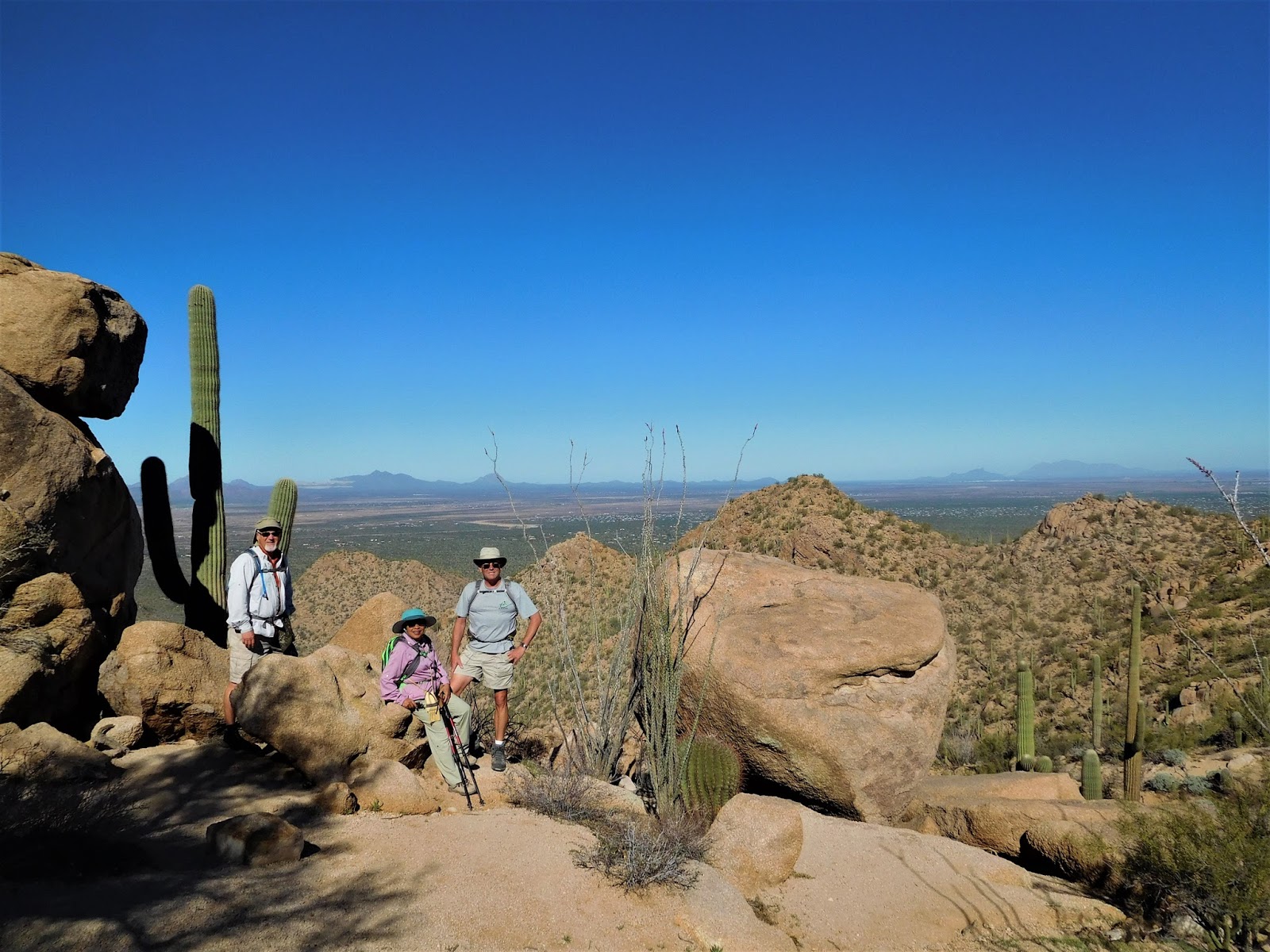
We'll make a loop around impressive Elephant Mountain....it's a pretty strenuous trail!


A little excitement along the trail...

The variety of flowers blooming in the Cave Creek area was stunning!

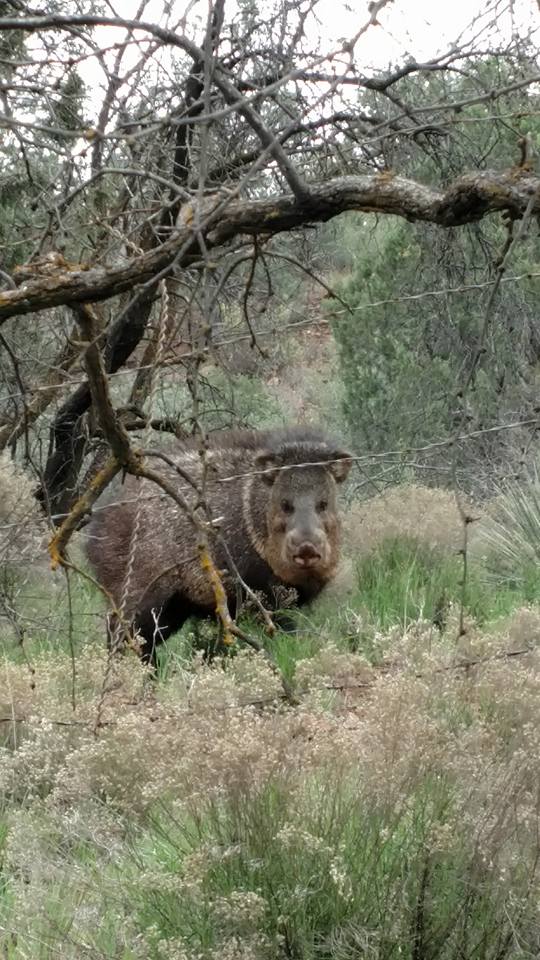
This javalina crossed the trail in front of us one morning on Go John Trail at Cave Creek.

Awesome site #8 at Cave Creek Regional Park.
Privacy, enormous separation, all day shade on the patio, views and birds.

Tomorrow we continue north to Camp Verde...into red rock country!


Thursday, March 2, 2017

A Couple of Stops in Tucson

We've spent the last week and a half in Tucson. First, in West Tucson at Justin's Diamond J RV Park, followed by a few nights at Catalina State Park in the far North East section of the Tucson metropolitan area.

We've spent quite a lot of time in this area in both 2013 and 2014 (click on the year if you'd like to read about our previous stays). Now that we've been on the road for over four years we've made lots of friends on the road and Tucson happens to be a popular place for nomads to winter...thus, this stay was full of social time, including several happy hours and a few recreational outings.

Instead of rehashing trails I've written about before and going on about various social events, I'm going to let the photos of our outings tell the story of our stay in Tucson...

We arrived in Tucson under threat of rain. Though the rain barely materialized, the clouds were stunning on an early morning walk on the trails behind Justin's RV Park.

We hiked Bridal Wreath Falls in 2013, this time John and Pam joined us.

We thought Bridal Wreath Falls would be a little bigger than this due to the recent rains.

Enjoying water in the desert with John and Pam.

Eagle eye Pam spotted this crested saguaro.

We biked from Justin's RV park one day and found this crested beauty on the way to Gilbert Ray campground.

We hiked the Hugh Norris/Dobe Wash Loop with Steve and Mona Liza one day.

Photo break after climbing the zillion stairs on the Hugh Norris trail.


Since Tucson is so spread out it was great to move up to Catalina State Park and focus on trails in NE Tucson. We love the views at Catalina! Plus we got to spend time with our local friends Dennis and Sheryl.

We may not have gotten one of the prime perimeter sites at Catalina,
but the middle sites still have great views and plenty of space.

Dennis and Hans hanging out on Alamo Creek, a wonderful little unmarked trail at Catalina SP.


Sheryl photographing me as I photograph her!

Hans and I hiked the steep, rocky Romero Pools trail one day and were surprised to see this blooming agave...
the only one blooming of the many miles we hiked in Tucson!

Agave chrysantha

Romero Pools


Log surfing!

Mark and Bobbie clued us in to the new Honeybee mountain bike trail so we joined them on a 20 mile ride one day. What a fun ride! Long, gentle uphill on mostly smooth trail, followed by a long flowing downhill. The entire trail winds among cactus so you must constantly watch out for stickers, but every stop provides expansive views. We learned that the best place to park (currently) is the empty dirt lot at the intersection of Golder Ranch Rd and Oracle Hwy. Plus...Nico's Tacos (next to Basha's) are a great way to refuel after this ride!


Only one flat tire among four people on 20 miles of trail through cactus...not too shabby!


Hundreds of these ground squirrels at Catalina State Park!

Lots of birds too!

That's it for Tucson for this year. Today we moved north where we'll hop around the parks surrounding Phoenix for a couple of weeks.