Friday, June 16, 2017

Revisiting a Favorite: Ashland, OR

We've stayed in Ashland, OR twice before and loved every minute of our time in this beautiful area just a few miles north of the California border (2013, 2014). This past week was no exception. Once again we stayed at Emigrant Lake County Park and enjoyed seeing the lake almost full; we've always stayed here in the fall when the lake is very low due to summer irrigation needs. (My campground review.)

We started our week off right with happy hour at Caldera Brewing, just a couple miles down the road from the county park.

Tasty brews at Caldera!

Lithia Park is always on our "must see" list when we visit Ashland. We just missed a riot of rhododendron blooms, but the creek and the gorgeous plantings in this 100 acre park are always a delight.  The park is especially stunning in the fall.

Not even a cold, wet morning could keep us away from Lithia Park.


So many lovely scenes in the Japanese Garden.

Thanks to former Ashlanders' Laurel and Eric for the tip on the Jacksonville Woodlands Trails. We got in a nice five mile hike through forested, rolling terrain, then a walk through the sweet town of Jacksonville.

Many of the forests in SW Oregon are full of madrone trees and lots of poison oak.
This particular Madrone was the largest we've ever seen!

Jacksonville is a historic tourist town, with some beautiful old buildings and a variety of nice shops to browse.

Historic Jacksonville, OR.

There's a large network of trails that can be hiked right from Ashland. The Oredson-Todd Woods Trails begin in a neighborhood on the south end of town and climb, often steeply, the lushly forested hillsides.

I think this is the largest mushroom we've ever seen!

This beauty posed just for us!

Living yard art.

Our most interesting hike of the week was a section of the Pacific Crest Trail (PCT). Starting at Little Hyatt Reservoir about 15 miles from our RV park, we hiked south on the PCT and added on the Green Springs Mountain Loop for a total of about 7 miles (map). The route took us through forests of pine and oak with scatterings of spring flowers and a couple of incredible view sites.

On the PCT bridge over Keene Creek as it leaves Little Hyatt Reservoir.

The forest was full of spring flowers including masses of these sweet little beauties.

Though most of the trail was through lush forest, a couple of times we broke out to long distance views of Mt Ashland, and Emigrant Lake.

There were some really exquisite flowers blooming at this time of year!

On the drive home we had an exceptional view of 9,495 ft tall Mt McLoughlin over Hyatt Prairie Reservoir.

We've moved on to Myrtle Creek for a month of family time on the banks of the South Umpqua River.

Our back yard view for the next month.


Saturday, June 10, 2017

Hiking 10,000 Year Old Black Butte

Due west of Mt Shasta and right next to Interstate 5 stands Black Butte. 10,000 years ago a volcanic eruption caused a crater where Black Butte now stands. Lava the consistency of toothpaste began oozing from the vent, and, through a series of four of these oozing eruptions, ultimately formed the 6,325 ft high plug dome that is Black Butte.

Black Butte viewed from the south along I-5.

The trail up Black Butte gains 1,875 feet over 2.5 miles, crossing the oldest eruption and the second eruption. Fortunately the incline is never too steep, the hardest part about this trail is how rocky it is, sometimes treacherously so. We were glad we had our trekking poles for stability on both large boulders and loose scree.

Black Butte viewed from the east.

The trail head is reached via a series of old logging roads with few signs, good directions are a must. The roads are in okay shape, just a few large potholes and one rutted section, a passenger car should be able to make it, very carefully.

The trail starts climbing through forest on the NE side of the butte and soon breaks out onto intermittent talus covered slopes. We were glad we'd waited for a cloudy day with cooler temps to make this trek.

A couple of lenticular clouds forming over Mt Shasta.

Those with a fear of heights should probably avoid this trail...the exposure is much worse than this, higher up.

Vibrant penstemon was a bright spot in an otherwise gray morning.

The dogwood were blooming too.

Coming around to the west side of the butte we were treated to views of the Eddy Range, residential areas of Mt Shasta City and several lava plugs along the north side of the main butte.

Looking straight up from the trail.

The trail clearly passed from one eruption to another and, as we climbed the north face of the main butte,
became much rockier. Care had to be taken with every single step.
Here, we are looking east as Mt Shasta starts to come back into view.

Looking back west towards Mt Eddy.

The summit is still quite a ways above us.

One must stop to appreciate the views, otherwise eyes on the trail at all times!

About half a mile or so from the summit the trail crosses a very loose scree field with steep and seemingly endless drops.
Here is a shot of a gabion retaining wall that has slipped. We had to work our way around it very carefully...it was even harder coming back down the mountain!


We made it!
It was pretty windy and cool on top so we didn't stay long.

I'm happy because I'm almost finished with the hard parts!

This was an amazing hike...challenging, with drop dead gorgeous views. We're glad to be able to say we did it but I don't know that we'd do it again...there were some very treacherous spots where one wrong move could prove disastrous. What an experience!

We finished our day with happy hour at the home of new friends Brice and Elaine and saw this lovely lenticular cloud over Mt Shasta. A fitting end to a wonderful week in the shadow of a great mountain.


Friday, June 9, 2017

A Week in the shadow of Mt Shasta

We've spent the past week in Mt Shasta City, an area we love and have explored some in the past. This time we never even drove up to the mountain; the road was only cleared to Bunny Flat which still had four feet of snow...no thanks!

On the drive from Redding to Mt Shasta we were thrilled to see Shasta Lake full to the brim!

What an amazing sight, Shasta Lake is practically full!!!!!
It's been a very long time.

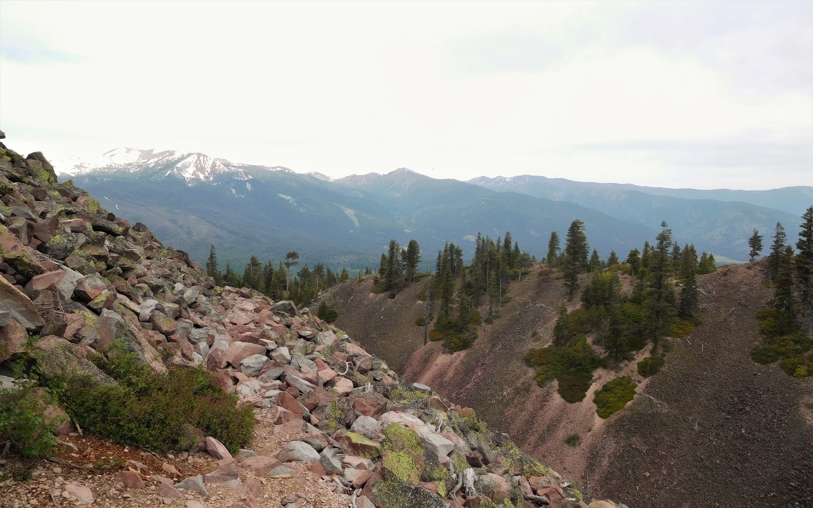
Spring Hill was our first hike in the area. Close to town, it's a 1.5 mile hike to the top of a small butte with lovely views of Mt Shasta.

Mt Shasta from the Spring Hill trail.

Near the Spring Hill trail head and adjacent to Interstate 5 at Mt Shasta City Park are the headwaters of the Upper Sacramento River. We saw several people filling jugs with water percolating out of the hillside...water that fell as snow on Mt Shasta about 50 years earlier.

Headwaters of the Sacramento River.

We were thrilled to welcome a very special visitor over the weekend, my daughter Chantal!

Chantal and I at Weed Ale House.

The three of us had a nice walk along three miles of the north shore of Lake Siskiyou. Unfortunately the bridge crossing the Sacramento River inlet had not been installed for the summer due to heavy runoff so we were unable to circle the entire lake. This is a mostly flat trail suitable for walking or biking.

Wagon Creek Bridge on Lake Siskiyou plus Mt Shasta.

The Mt Shasta Sisson Museum, near Lake Siskiyou, is an excellent place to learn about the area's history. Everything from Native Americans to logging, trains, skiing, and the lenticular clouds that form over the mountain. There's even a fish hatchery on the grounds.

Feeding the fish at the hatchery at the Mt Shasta Sisson Museum.

One of the most popular hikes in the area is the McCloud River Falls trail. Much of the flow of the McCloud River is shaped by lava and three beautiful waterfalls occur where the water could not cut through tough bands of basalt. Though all three falls can be reached by car, we parked at the lower falls and hiked to the upper falls for a gorgeous 4 mile round trip walk.

Lower Falls on the McCloud River

Middle Falls on the McCloud River...note the guy on the left about to jump.

Looking down on the Middle Falls.

Upper Falls on the McCloud River.

Lava channel leading to the Upper Falls.


After a wonderful few days with Chantal, she returned to her regular life and we continued our typical daily exploring of the area. The Gateway trail system is a pretty new series of trails right on the edge of Mt Shasta City with, of course, fabulous views of the mountain. We did a nice seven mile lollipop loop and finally, after weeks of seeing signs, saw a bear!

Mt Shasta from the Gateway trail.

Strolling through swaths of flowering thimble berry plants on the Gateway trail.

Just barely managed to photograph the bear we saw strolling through a ravine about 75 feet below us on the Gateway trail.

We had one more amazing hike in the area but I have too many photos for this post, stay tuned!

Today we move on in to Oregon...more time with Chantal and James, and lots of beach time ahead of us this summer!