Monday, April 29, 2013

Campground Review: Elephant Butte Lake State Park

Elephant Butte Lake State Park is New Mexico's largest state park and reservoir. There are several campgrounds with water and electric hookups, marinas and all the dispersed (no hookups, no specific site; also known as boondocking) camping you could possibly want. All types of water sports are allowed on this reservoir.

The water level is very low due to a prolonged, severe drought in the region, so campgrounds that used to be  pretty close to the water are now a bit of a hike to the waters edge...but if you boondock you can camp right next to the water. Dispersed camping seems to be allowed anywhere in the state park. BUT...there is the danger of getting stuck in the sand when getting your RV down to the water! Extreme caution is advised!

We chose to camp with hookups and were glad we did because temps were in the 80's during our stay and it was nice to be able to use the AC in the afternoons.

All of the campgrounds have many very large sites that would fit any rig. We did notice that some of the super long pull through sites in the Quail Run campground were on a pretty good slant. The South Monticello campground is the most remote, being at the North end of the lake, but had huge sites and a nice view of the lake at the point where the Rio Grande river enters the lake. Each campground provides a shower/restroom facility.

We stayed in the Desert Cove campground in site #6. It is a perimeter site with a fire pit and picnic table ramada. Roads and sites are paved. Spacing of sites is excellent, especially the perimeter sites. We paid $14 per night. This campground was close to the towns of Elephant Butte and Truth or Consequences so we had fuel and restaurants within 2 miles and groceries within 5 miles.

Very quiet at night. Decent 3G Verizon signal. The campground has free wifi but we did not try it.

We hung our bird feeders and had excellent bird watching right at our site. At least a dozen different types of birds plus rabbits and squirrels visited the food and water.

This state park is supposed to get very, very busy on holidays (water in the desert draws everyone from near and far), 100,000 people can pack the place on a busy weekend. We did notice the campgrounds were almost full over the weekend and there were many more dispersed campers on the lake as well.

Our site #6 at Desert Cove.

We had a picnic table with ramada and fire pit.

View from our door, nothing but desert!
Ramada to the right, finch sock hanging from the tree on the left..

Our bird site: finch sock, seed feeder and a bowl of water.
Site #7 is in the background, it was occupied during the weekend only.

Boondocking at the lake.
Photo taken on Thursday...it got a lot more crowded on the weekend.


Sunday, April 28, 2013

A Little More Elephant Butte Plus a Little T or C

We've explored the South, or dam end, of Elephant Butte Lake and found that the birding was excellent just below the dam. There is a very short (~1 mile RT) trail that follows the riparian area where the Rio Grande flows out of the dam. Right now the water is extremely low but the birds were abundant and varied...different birds than we saw along the West and North portions of the lake. No pics of the birds but the variety was worth a mention for bird lovers.

Looking South beyond the dam, the riparian area is full of a variety of birds.
Looking North beyond the dam you see the "Elephant Butte" the lake is named after.

We've also explored Truth or Consequences, the "big" town just South of the lake. Renamed (from Hot Springs) after winning a contest sponsored by the game show of the same name in 1950, T or C is a struggling small town that seems to rely on the influx of tourists that visit the hot springs that run under the town and the recreation lovers that visit the lake.

Fence art.
White Coyote Cafe.
Art wall outside the Geronimo Springs Museum.

We've capped off our stay in this area with a soak in one of the T or C hot springs: Riverbend Hot Springs. Riverbend is the only hot springs that sits on the banks of the Rio Grande. They have slate lined soaking baths that range from 100 to 106 degrees. We chose to use the public pools for $10/hour each. If you stay in the lodge or one of the RV spaces (not particularly scenic) you can soak all you want for free!

Riverbend Hot Springs entrance.

Patio and soaking pools on the Rio Grande river.
This part of the river has a small dam to make it a little more scenic through town,
as opposed to the trickle we saw below the Elephant Butte dam.

Tomorrow we're off to Albuquerque for a week. Hans lived there in the early 80's for a few years so we'll see how much it's changed.


Saturday, April 27, 2013

Elephant Butte Lake, an Oasis in the Desert

We're spending a few days at Elephant Butte Lake State Park, New Mexico's largest state park and reservoir. The water level is very low due to a prolonged, severe drought. We've heard that this park gets very, very busy because all water sports are allowed and we are in the middle of the desert, but right now it is fairly quiet.

There isn't a whole lot of hiking around here, but that's okay because the temps are in the 80's right now, a little warm for much hiking anyhow. Yesterday we spent the morning exploring the Western shore of the lake.

You can see Hans at the edge of the lake in the center of the photo.
I am taking this a good 100 yards up the slope and am not even at the
high water line...this lake is super low.

There are clusters of these slabs of stone along the shore.
Perhaps some kind of sandstone, they were very cement-like.
There are also clusters of these round ball-like rocks.
Due to the hot springs in the area, Hans surmised they might be bubbles formed
from sulphurous gasses escaping under water and then hardening.

Some of the tamarisk trees are in full bloom.

We happen to be camped in a campground (and glad we are so we can use our AC in the afternoon) but dispersed camping is allowed in this state park. Check out these amazing campsites people have landed at. Having seen the sand they drug their trailer over, I can't imagine how they are going to get back up to the road!


We drove to the North end of the lake and did some exploring where the Rio Grande river comes into the lake.

The Rio Grande river...the name seems too grand for the reality!

Birding was quite good at the lake, especially at the North end. We saw a few birds that were new to us including White Faced Ibis, American Avocet (in their summer colors) and Canada Geese (I figured they would have already headed North, guess those recent storms affected travel). We also saw a coyote roaming the open grassland.

Canada Geese watching us closely...

It's nice to spend a few days relaxing near a body of water. We've got a wide variety of birds at our bird feeders at camp, making just hanging out at home a pleasant, low-key way to spend an afternoon.

Thursday, April 25, 2013

Campground Review: Rose Valley RV Ranch, Silver City, NM

Rose Valley RV Ranch is close to town but situated in such a way that you feel like you are in the country. Site of a former dairy farm, the 44 acre property is peaceful and natural. Though it is just two blocks off busy Hwy 180, the property is in a small valley sloping away from the road and is very quiet; just a bit of road noise in the day and none at night

There are 57 sites and 14 of those are pull throughs. Roads and sites are gravel, many have a slight slope. Each site has a private sitting area with a unique, rustic feel. Sites are large and very well separated from each other with natural space between them. There are also a few rental cabins.

Facilities include a small laundry room, fitness room and exchange library, and full recycling. The old barn is now a rustic meeting space. We saw a wide variety of birds during our stay...despite the fact that we did not put out our bird feeder. We had been advised that at this time of year bird feeders attract javelinas and skunks. There are a couple of miles of walking trails out behind the barn.

During the month the park was about 50% to 80% full. There are a number of folks who live here permanently or very long term (several years) but all of the permanent sites were neat and clean and not overwhelmed with "stuff".

Very few folks walking the RV park during our stay, so if you enjoy socializing with your fellow campers that could be kind of difficult. Also, the windy afternoons ensured not too many folks were hanging around outside their rigs. If privacy is your thing, then this is the place for you!

The park is two blocks from bowling, groceries and a few eateries. The usual big box store is half a mile away and downtown is 1.5 miles.

We paid $350 + electric for a one month stay. Decent 4G Verizon signal here, though the parks wifi was very slow so we used our own.

This park checked all the boxes for an excellent stay: reasonable price, large sites, privacy, natural space, trails from the park, proximity to services. We would definitely stay here again.


Our site #46. That's a rental cabin beyond our rig.
Our privacy fence in the foreground. Photo taken early on during our stay,
the tree leafed out nicely during the month.

Front view of our site #46 looking in to our sitting area.
Our neighbors rig on the left.

View down the open natural space behind the back in sites.

A trail behind the rv park.
Mementos from the dairy history of the RV park are placed around the property.
View is down the middle of two back-in rows.

The Barn/meeting hall. To the left are horseshoe pits and a community fire pit.


Tuesday, April 23, 2013

Wrapping up our Month in Silver City

Neither of us had ever been to Silver City before. We booked a month because it was an area that looked like it had a lot of hiking and exploring to do, the RV park looked nice and had an excellent monthly rate, and we like to build some down time into our travels...we don't like feeling that we always have to go, go, go and see lots of things quickly because we're just passing through. This has been a thoroughly enjoyable month.

Tonight we're having dinner with a wonderful couple we've met, Bill and Heidi. They are full timers also, who spent the winter in Baja California. We've got one more full day before we head for Elephant Butte Lake State Park near Truth or Consequences, NM.

First, the RV park, Rose Valley RV Ranch, is a wonderful place to stay. I'll post a review soon, but I definitely recommend it for any length of stay.

Rose Valley RV Ranch use to be a dairy farm. Old farm implements are scattered around the property.
View is down a row of back in sites.


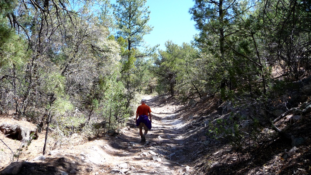
If you've been reading this blog for any length of time you know we like to hike. We hike 5 - 7 miles almost every day, with an occasional 9 - 11 mile hike or a mountain biking day thrown in for variety.

Heading up Hwy 15 beyond the small town of Pinos Altos
you can see hoodoo's forming on the hillsides.

The hiking within 10-15 miles of Silver City is abundant and fun and if you want to drive further you'll find tons more excellent trails to keep you fit and happy. For details on some of the hikes summarized below take a look at my posts between March 25 and April 25, 2013.

The local trails we hiked were:
  • Boston Hill - Adjacent to downtown Silver City are several miles of trails situated among the city's original mine pits. Convenient, with great views of the city and surrounding area.
  • Gomez Peak/Little Walnut trail system - Only about 5 miles North of downtown, this trail system offers many miles of trails from easy to strenuous. We hiked just about every trail here and found the strenuous parts were always less than a mile in length and provided fabulous views from the local peaks. You can also access the Continental Divide Trail from here.
  • Fort Bayard Trail System - Extensive trail system about 5 miles East of Silver City. Excellent hiking and mountain biking with everything from easy to strenuous and interesting sights such as petroglyphs, a giant juniper tree and old wagon wheel ruts. This trail system connects into the Gila Wilderness so you can continue for many, many miles.
  • Saddlerock Canyon - Neat little canyon about 15 miles NW of town. Cool rock formations and pictographs.
  • Bear Mountain Lodge - A lovely lodge set in rolling hills just a few minutes North of downtown Silver City with a few miles of trails (open to the public) that abut the Gila National Forest. Neat artwork scattered on the property and in the lodge.
  • Continental Divide National Scenic Trail (CDT) - Part of this 3,100 mile trail passes through the Silver City area and there are several access points within 20 miles of town. I couldn't find a good map online, but we got an "okay" map from the Silver City ranger station just off Hwy 180. A good forest service map would be the best option. We accessed the CDT at five points:
    • Little Walnut Rd: There is a dirt parking area about a mile beyond the Little Walnut picnic area. We chose to walk North on the CDT for about 2.5 miles over rolling terrain through mostly scrub oak and juniper and turned around just before the trail headed down a long hill. 
    • Burro Mtn Homestead: Located off Hwy 90, South of Silver City, this dirt road takes you past the Tyrone Mine. We accessed the CDT just beyond the Burro Mtn Homestead RV Park (an ATVers heaven) and headed South on the trail. We went about 2.5 miles over hill and dale, through Ponderosa, juniper and oak forests, had some good views and saw the biggest javelinas we have ever seen.
    • Little Walnut/Gomez Peak trailheads: You can link into the CDT from the Gomez Peak/Little Walnut trailheads via the CDT Access Trail. The CDT Access Trail is an awesome gentle downhill single track weaving through Ponderosa Pine forest and when it connects to the CDT continues South West in this smooth, downhill fashion...it was a wonderful hike and looks like an amazing mountain bike opportunity. 
    • Bear Mountain Rd. - Drive about 2.5 miles from the beginning of Bear Mountain Rd (a dirt road) to where the CDT crosses the road. We hiked North for about 3 miles until we reached the point we had hiked from Little Walnut/Gomez Peak CDT Access Trail. Nice views on this section.
    • Arrastra Site: Located on Hwy 15 about 8 miles North of Silver City, the Arrastra Site is an ore grinding site from the 1860's. We took the CDT North and it started out as an ugly jeep road and soon became a trail headed up the Arrastra Site mountain. About a mile up we saw the trail was bypassing the tops of some hoodoos about 20 feet off the trail...well worth checking out. We went about 2.5 miles and trail seemed to be following old road beds up the mountain, probably used to transport ore in the 1860's. 
Further afield, the Gila Cliff Dwellings National Monument and Lake Roberts area have lots to offer in the way of history and hiking and gorgeous scenery. There are many more trails and sights to explore within 50 miles of Silver City, making this area something of a retirement destination.

Hanging out on top of hoodoo's overlooking the Hwy 15 corridor in the Gila National Forest.

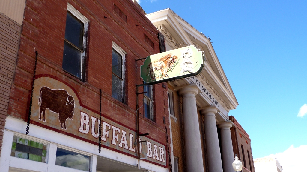
Downtown Silver City, like most small towns these days, is struggling but puts on a pretty face with beautiful old houses and funky artistic details scattered about. Decent restaurants abound in the area, and even though we don't eat out often we were glad to be in a part of the country where spicy really means spicy!

Mural at the Silver City Food Co-op

The Buckhorn Saloon and Opera House in Pinos Altos, just 6 miles North of Silver City, is a neat old place to catch live music a couple times a week and have a bite to eat.

The Buckhorn Saloon in Pinos Altos.

Silver City was a wonderful place to layover for a month. I think it would be really pretty to visit in September/October, after the monsoonal rains have greened things up and the fall colors start to turn. It can be quite windy in New Mexico in the spring and we did experience some pretty windy days, but rarely was it too windy in the middle of the day to keep us indoors.

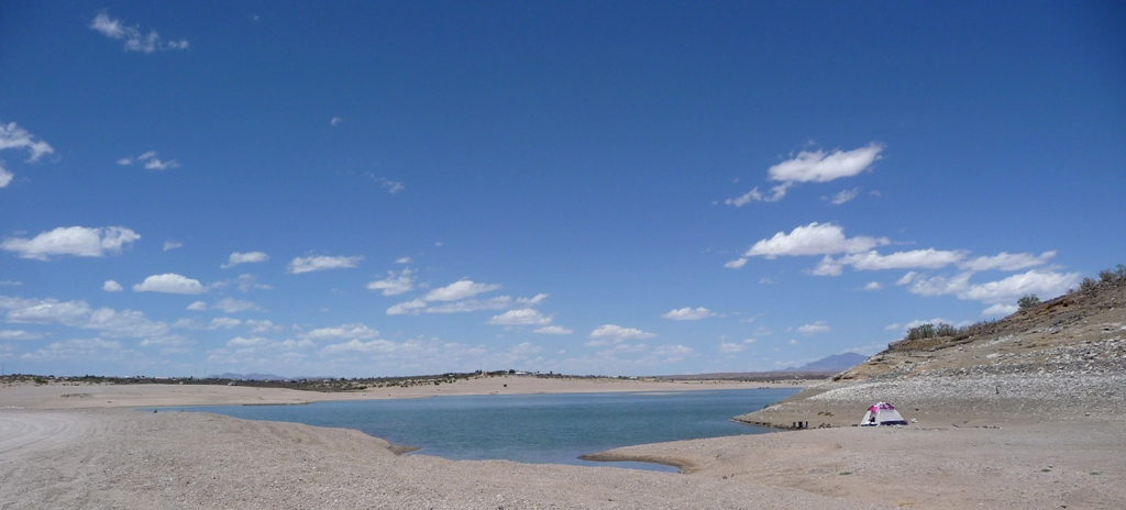
I think Silver City could be on our list of potential places to settle down in the future if it weren't quite so dry. The nearest water sources (Lake Roberts and the Gila River) were at least 30 miles North, and most of their rain falls in July and August.

Biking along a stream bed at Fort Bayard
Fording the Gila River near the Gila Cliff Dwellings.
View of the Santa Rita Mine from Hwy 152;
The second largest open pit copper mine in the world.
Javelina seen on the CDT.

Stay tuned for new adventures as we head North through New Mexico and on in to Colorado for the summer.

Saturday, April 20, 2013

Going Back in Time on the Woodhaul Wagon Road

We've hiked and biked a number of trails in the Fort Bayard Trail System, just five miles East of Silver City, NM; mostly staying on the low, rolling hills in the Southern part of the System. On this day we decided to hike the Woodhaul Wagon Road, taking us up into the larger hills in the Northern portion.

This photo, taken on another hiking day, shows the typical low rolling hills of the Southern portion of
the Fort Bayard Trail System. To hike the Woodhaul Wagon Road we head up into the hills in the distance.

This excellent six mile hike started at the Fort Bayard Administrative Site Trailhead which is located on a dirt road a few miles beyond the Fort Bayard Historic Site. Our route was: Big Tree Trail, Woodhaul Wagon Rd Trail, with a short offshoot to Cameron Creek, a second offshoot to the Rut site, then return on Stevens Ranch Road.

Once we turned off the Big Tree Trail we started a gentle ascent into the hills following the Woodhaul Wagon Road. During the days of the Fort Bayard Military Reservation (starting in 1865), this road was used to transport wood from the Pinos Altos mountain range to the Fort by mule and oxen carts. Our goal was to see the wagon wheel ruts carved into rock over many years of heavy use.

As we headed up hill the trees and brush became thick and the road more defined.


After about a mile of gentle climbing, we came to an intersection and a gate. Taking the trail to the left we entered a lovely meadow bisected by a creek (Cameron Creek) where we saw several white tailed deer.

A meadow at about 7,000 elevation, with more hills of the Gila National Forest surrounding it.

A shady glen just beginning to show spring green along barely flowing Cameron Creek.

At this point the trail petered out and we headed back to the trail intersection and passed through the gate. Soon we saw a sign indicating the wagon wheel road continued up the hill to the left. After a short distance our persistence paid off and we were standing in the wagon wheel ruts!

Countless wagon loads of wood were hauled  over this route in the late 1800's, gouging ruts into the stone.

Hans walking down the wagon trail.

Here you can see how deep the ruts cut into the stone.

We hiked a bit further up the road and took in the view to the South East.

The light colored ridge in the distance is the Santa Rita Mine...
the second largest open pit mine in the world.

One of the things that has surprised me the most about our stay in Silver City is the lack of spring flowers. In my naivety, I just assumed that spring flowers were the norm everywhere. Not so at 6,000 ft elevation and a semiarid climate! So I was shocked and happy to see this splash of color all by itself on the trail.

One, single paintbrush plant!

We made our way back to the trail intersection and headed on down Stevens Ranch Road; talking of the conflicts between the native inhabitants and the newcomers intent on taking over the land and the incredibly rough life (compared to ours) they must have lived back in the days when these roads were in use.

At one point we were being watched by a local:


Back to the lowlands where we began.

This was very a enjoyable hike through a variety of terrain. The Woodhaul Wagon Road actually is an 11.5 mile trail that connects to the Signal Peak trail system.


Wednesday, April 17, 2013

Silver City's Subtle Charms

Western New Mexico University, located in Silver City, is the home of an excellent museum housing the largest collection of prehistoric Mimbres Mogollon pottery and artifacts as well as an interesting collection of memorabilia and photos depicting the history of the university dating to its inception as a teaching college in 1893.

Entry to the museum is free. The pottery collection is vast and the detailed history provided on each period of the Mimbres culture is exceptionally well done. The painted pottery designs are intricate and finely detailed geometric and figurative animal and cultural designs. Well worth your time to visit.

Any walk in downtown Silver City is full of architectural fun and variety. There are many buildings from the late 1800's, some are well restored.


Nice looking art deco administrative building.


Many of the residents and business owners like to play with color.


There are some nice hiking trails at Bear Mountain Lodge, located just a few miles from downtown Silver City and nestled against the Gila National Forest. The Lodge looks like a wonderful place to stay and has some lovely artwork placed throughout the lodge and also on the grounds, courtesy of the Blue Dome Gallery.


Unique labyrinth on the Lodge grounds

Fun sculpture on the Lodge grounds