Tuesday, August 6, 2013

A Couple of Beautiful Hikes Near Hamilton, MT

Lake Como Loop Trail

About 12 miles South of our base camp in Hamilton, MT lies lovely Lake Como. This natural lake was dammed in 1905, making it larger to provide seasonal irrigation for the Bitterroot Valley. Today all water sports are allowed on the lake and it continues to provide for seasonal irrigation needs in the area.

We hiked the 8 mile trail around the lake and wished we had brought our swim suits because the water and looked real inviting by the end of our hike when the outside temperature was around 80 degrees and there were several happy people in the water.

This was an easy and beautiful trail with several streams entering the lake, a couple of lovely white sand beaches on the South side and good opportunity for sighting birds of prey. We saw two osprey nests with chicks and the adults nearby as well as an eagle...it may have been an immature bald eagle or a golden eagle.

Lake Como viewed from the dam.
The fine white sand and crystal clear water rivaled beaches we have enjoyed in Hawaii.

A snake in the lake!

Rock Creek entering the lake.

Adult osprey keeping an eye on the chick in the nest nearby.

Young osprey looking ready to try its wings.

Magnificent Blodgett Creek and Canyon Trail

After seeing Blodgett Canyon from the Overlook Trail the other day and talking to a couple of locals who mentioned a stone arch a few miles into the canyon, we decided that would be our last hike in the area. What an excellent decision that turned out to be! This was a gorgeous hike...one I'd do several times a year if I lived in the area just to see the canyon in all its different stages.

The Blodgett Creek and Canyon Trail extends about 12 miles to Blodgett Pass and Lake. The canyon suffered a devastating fire in 2000, which served to open up the views and encouraged plentiful growth of all types of plants. It's about 3 miles or so until you see the arch and cross a bridge and another mile or so  to a waterfall which became our lunch and turn around point.

One of the most striking features of Blodgett Canyon are the
massive, towering rock formations on the North side.

These walls must rise 1,000 feet above the trail!
This is a popular climbing site, though we did not see any climbers on this day.

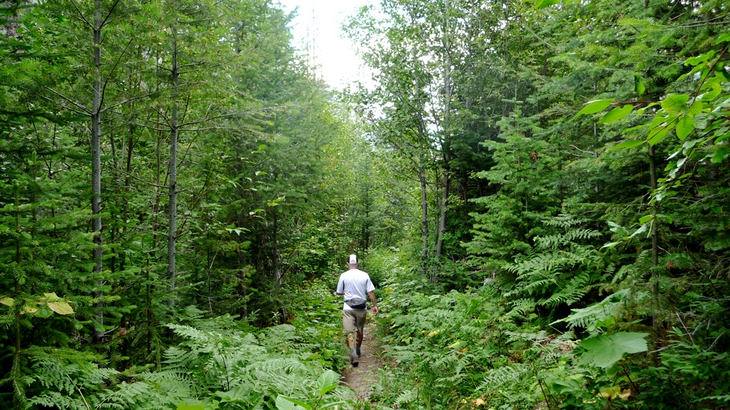
The trail occasionally passes through lush stands of new trees,
ferns, berry bushes with small streams flowing out of the hillside.

The water in Blodgett Creek is crystal clear.

Cloud imitating spires!

Looking up canyon.
The arch comes in to view on the South side of the canyon.

A little different than those sandstone arches we admire in the South West!


Christmas ornament berries!

This waterfall is about 4.5 miles in.


Rose Hips!

Tomorrow we move on to Missoula for a few days. We'll overlap with some fellow full timers at Jim and Mary's RV Park, should be fun!

Monday, August 5, 2013

Hanging Out in Hamilton

The largest town in the Bitterroot Valley, Hamilton, MT is bisected by the Bitterroot River and bordered by the 10,000 foot peaks of the Bitterroot Range to the West and Sapphire Range to the East. The valley's pleasant climate has been called the "banana belt of Montana", and ranching, fishing and hiking are key past times here.

This beautiful area is worth a longer visit, but we have three whole days and are determined to make the most of them. Of course we had to start out by visiting a local brewery, of which there are two in town. For our first evening we visited Bitter Root Brewery because they had live music (the beer was good too)!

Sign at the Bitter Root Brewery, specific to breweries.
When breweries starting popping up everywhere the state felt the need
to control the drinking at the tasting rooms.

Our first full day in town was busy. We hiked a short but sweet trail with fabulous views of Hamilton and glacially carved Blodgett Canyon. Blodgett Overlook Trail is only three miles RT and just a few easy miles West of town. The day we hiked this trail, the Valley was hazy with smoke from distant fires but Blodgett Canyon was clear:

Blodgett Canyon

Hamilton was founded by copper magnate Marcus Daly in the late 1800's and his home, Daly Mansion, on the East side of town has been restored and is open to the public for tours. We decided to just walk the grounds, a lovely arboretum, (for free) and enjoyed the enormous trees planted over 100 years ago.

Daly Mansion


17 miles North of Hamilton, the Lee Metcalf National Wildlife Refuge contains 2700 beautiful acres along the Bitterroot River with wetlands, grasslands, and mixed conifer and deciduous forest. During our brief visit we walked the 2.5 miles of trail and drove through the refuge and saw two muskrats, 10 white tailed deer, 2 bald eagles, woodpeckers, cedar wax wings, several varieties of ducks and an osprey. Bring binoculars and bug spray and you will not be disappointed!

A pair of bald eagles.

Curious white tailed deer.

Cedar wax wing

We've got a couple of longer hikes planned for the next two days in this gorgeous area. Wish we could stay longer, but this little taste of Hamilton has assured us the Bitterroot Valley is a lovely place to spend some time.

Saturday, August 3, 2013

Bayhorse: A Well Preserved Ghost Mining Town

We're spending a couple of nights in Challis, ID at the Challis Valley RV Resort. It's a no frills RV park with huge sites, friendly hosts, inexpensive laundry, and hardly anyone staying at this huge park (36 acres and only a handful of RV's). At the Passport America rate of $18/night it's been a very quiet and convenient place to stay.

Hans is riding the bucking bronco stationed at our site!

As we approached Challis we could see smoke in the mountains West of town. Turns out it is the Lodgepole fire and has burned about 20,000 acres so far. Even though the fire is about 10 miles North West of us, we've only smelled smoke twice when the wind changed direction for a bit.

Challis is situated along the Salmon River and nestled up against the Salmon/Challis National Forest. Fishing, hiking and ATVing are popular in the area. Having only one day to explore and some roads being closed due to the fire, our best option turned out to be an excellent one: Bayhorse Ghost Town.

Bayhorse historic mining town is just a few miles South West of Challis, up a narrow canyon on a good dirt road. The site was discovered in 1864, though lead-silver ore was not successfully mined until 1872. Mining in the area was most profitable between 1882 - 1899, once charcoal kilns were built to better process the ore. Mining continued sporadically into the early 1900's. Today, the state of Idaho has preserved (not restored) the buildings and mining equipment for our viewing pleasure.


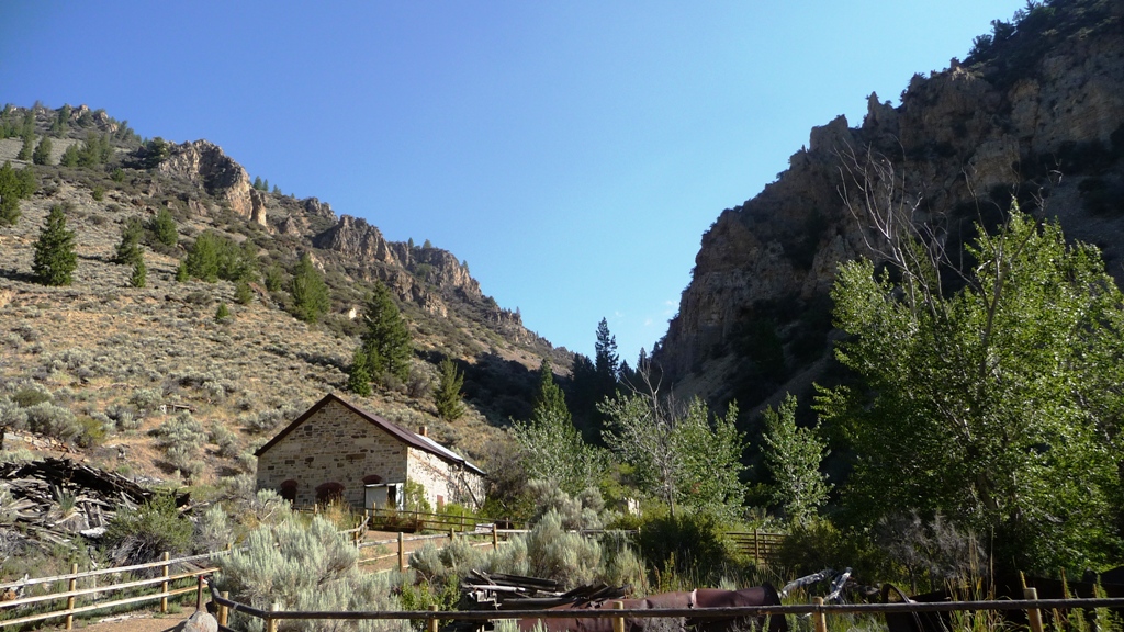
Bayhorse Mill


Charcoal kilns. These were originally beehive shaped.


Bayhorse Hotel
One of the earliest structures in the canyon.

Residence that was added on to over the years.
The towns doctor lived here. He was originally an orderly in the Civil War
and did not have full medical training.


After touring the town site, we continued up the dirt road towards Bayhorse lakes. Along the way, more mining ruins were perched on the hillsides and along the creek.


Much of the ore processing was accomplished using gravity, as is evidenced by these buildings
perched precariously on the mountainside.


At Upper Bayhorse Lake we hoped to do some hiking. We were able to find an ATV trail and followed it for a while, but the expected hikers only trail never materialized. Luckily, there were no ATV's around during our visit. The fishermen on the lake seemed to be having lots of luck.


Back on Hwy 75 heading towards Challis we admired the rugged mountainsides and searched for bighorn sheep.

Salmon River on the right.

The farm land along the river is a big draw for the bighorn sheep.


Challis turned out to be a nice stop over. It's worth a longer visit, and perhaps we'd stay at the Challis Hot Springs next time (it's more expensive than our current RV park).

Today we're off to Montana for the next few weeks. First stop, Hamilton, MT.


Thursday, August 1, 2013

Campground Review: Juniper Campground at Ririe Reservoir, Ririe, ID

We had a gorgeous 120 mile drive yesterday from our boondocking spot just North of Pinedale, WY to Ririe, ID. We started in rolling green hills and headed into the mountains, followed the Hoback River canyon, then the Snake River. Entering Idaho, the terrain slowly changed to rolling fields of wheat and potatoes.

We stopped for one night at the Juniper Campground at Ririe Reservoir. It was a lovely and inexpensive stop among the farm fields. Roads and sites are paved. Each site has a picnic table and fire pit and grassy area. Full hookups are only $18 per night.

Amenities include very nice restrooms with showers, a 9-hole disc golf course, all types of boating are allowed on the reservoir. We had excellent 4G Verizon signal, using our own internet service.

We only stayed one night and did not explore the surrounding area. This park was beautiful, quiet and inexpensive; a perfect place for a stopover.

Site C-8


Ririe Reservoir

Playing the 9-hole disc golf course with wheat fields and a storm
in the background!