Saturday, April 5, 2014

The Best Hangover Ever

The goal for the day was an 8.6 mile lollipop loop on the Munds Wagon, Cowpies and Hangover trails then back to Munds Wagon trail. The Hangover Trail is a fairly new addition to the official Sedona trail system; it's a double black diamond mountain bike trail so we knew from our experience (hiking) the Hogs Trails the other day that this should be an interesting walk.

If you decide to do this lollipop loop, don't make the mistake we did that turned our hike into 11.5 miles! Since the Hangover Trail is not yet on the the local trail maps we relied on the article linked above for our directions...but I did not print it out. I skimmed over the fact that one must take the Schnebly Hill Rd turn off from the Munds Wagon Trail at about 2.8 miles in order to access the Cowpies Trail. Sedona needs to put a little sign under the Schnebly Hill Rd sign that says "to Cowpies Trail"!

Here's a look at our great day on the trail. We had a little weather come through the night before so we enjoyed a dusting of snow along the shady parts of the trail. The pictures along the Hangover Trail don't adequately depict how scary some of this would be on a mountain bike...believe me it IS a double black diamond ride!

Looking up canyon, on our left were fabulous red rock formations.
Little did we know we would cross over the middle of the distant set of red rocks
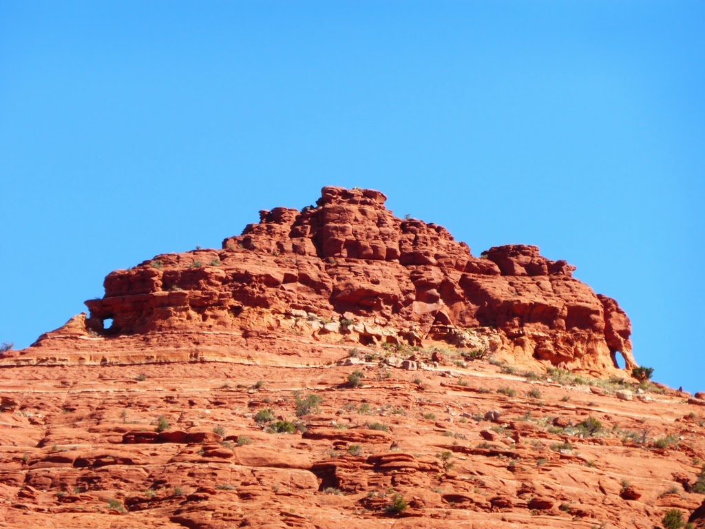
and come back on the left of the round topped rock in the center.

Check out the little arches at each end of this fin!

By the end of the day those sun shafts will have melted all the pretty snow.


A beautiful scene looking down the canyon we ascended...
unfortunately the oozy red rock in the center is the Cowpies we bypassed!


The cowpies are enormous!

Notice the warning for mountain bikers...

The mountain on the opposite side of the canyon sported white stone.


A look back up canyon as we depart the cowpies.
The trail is now riding sandstone ledges, sometimes narrow.
 

We followed white paint tag marks on the rock as they zig zagged
a way up the rocks to the pass on the left above us.

The pass was impressive and dramatic!

The view on the other side was incredible.
The Midgley Bridge on Hwy 89A is in the center with Mt Wilson rising above it.

A look back at the saddle we crossed.
The trail took us down the rock face of the saddle about 50 feet then we started a
traverse of a shelf lined with trees.

This is the trail we now found ourselves on, basically a treed shelf overhung with rock...the Hangover.

The trail goes between the rock and the tree and drops off the edge...
imagine riding your bike here...

This is deceptively smooth looking...
often the drop offs or strategically placed rocks made the trail treacherous.


Another look back at the saddle we crossed.
Our trail is in the horizontal band of trees.

We've now come around the mountain far enough we have views of Sedona.

We could see our trail would cross between our rock face and the one opposite us...
but we had no clue how it would get down our rock face...

The white tags started zigging down the rock face...

Then the tags went straight DOWN the rock face!
Imagine yourself riding a bike down this...or pushing it up!

Follow the vertical white tags!

Ahhhhh, now we're back on "level" rock.

A colorful look back at the valley North of Sedona.

This one was about to burst into bloom.


These colors are untouched...can you see why we love this place?!

Tuesday, April 1, 2014

Out and About in the Verde Valley

Choosing to spend a month in Cottonwood, AZ, with its easy access to Jerome, Camp Verde and Sedona has been an excellent decision! There is so much to do within 20 miles of our home base. Here's a sample of the past few days...

We hiked the Secret Canyon Loop, a moderately strenuous set of trails into the Red Rock Secret Canyon Wilderness. The hardest part was the road to get to the trail head. We'd read that it was rough and high clearance was recommended, boy were they right! Our truck performed beautifully, but we probably won't attempt this road again with this big vehicle!


4.5 miles of road like this to the trail head.

A slot full of water!

Lots of trees and bushes and some great rock views.


Since our arrival on March 13 we've made it up to Jerome each Saturday afternoon for live music at the Spirit Room. Free music, good beer and people watching, plus the funky charm of Jerome...how could you go wrong!

Always lots of motorcycle riders in Jerome, this guy had a particularly unique ride.


The old miners cemetery was the site of a geocache find.

We got to explore the rugged mountains South East of Camp Verde with new friend and blog reader, Jeanie. Jeanie lives in Cottonwood and knows the back country around here well; it's been a real pleasure getting to know her.

This particular outing was exploratory, we'd read about some ancient ruins along Towel Creek and thought we'd try to find them. The ruins eluded us but we had fun trying to get to them...fording the Verde River was included in this adventure!

Rugged landscape outside Camp Verde, very few roads cross this terrain.

This little guy greeted us at the trail head.

Lightning rocks!

Here's Jeanie fording the Verde River to get to Towel Creek. 

Chalcedony pockets in the creek bed.

The local residents were looking for handouts from us after the hike.

Yesterday we checked out the popular Broken Arrow trail area of Sedona. There's lots of fantastic red rock formations around here such as submarine rock and chicken point, and the ubiquitous Pink Jeep tours are all over the place, taking folks on some wild slick rock rides.


Several times we were buzzed by this B-17.

There's supposed to be a geocache up on top of this pile of rocks,
we took a pass on that one...the terrain was pretty treacherous!

This solitary beauty represents our lovely lunch site away from the crowds
when we took an unmarked "social trail" into the wilderness.

After our little trek into peaceful wilderness we tried a different route back to the truck. There are a few new trails just now being developed for official inclusion into the Broken Arrow Trail System: the Hogs Trails are expert level, triple black diamond, mountain bike trails. They include High on the Hog, Hog Heaven and Hog Wash. We hiked them and could not imagine riding them, but we sure would love to see the experts do it! I couldn't get a any good representative photos of the extreme difficulty of these trails, but they were pretty mind boggling and are worth a look if you are in the area.

This was an easy section of Hog Wash, I loved the flowy, oozy looking slick rock!