Tuesday, November 3, 2015

Hangover Hiking with Friends

We have good friends from San Diego meeting us in Sedona for a few days so we decided to go all out and stay at the fancy RV park right in Sedona: Rancho Sedona RV Park. There really aren't any special amenities here, but the park is very pretty and it's right next to the heart of the Sedona tourist area so it's close to many trails and close to our friends hotel, thus making it worth the highway robbery price for a few nights. And the blazing fast 4G Verizon signal is much appreciated after our excrutiatingly slow signal in Camp Verde.

Thanks to a cancellation we got site #77, with excellent site separation and a gorgeous setting.
Oak Creek is just behind the berm in back of our rig.

Oak Creek.

But before our San Diego friends arrived we planned a big hike with RVing friends who happened to be staying in the area. Steve and Mona Liza and Howard and Lauren joined us for a repeat of a hike Hans and I had done (twice) in 2014: The Best Hangover Ever!

This eight mile lollipop loop took us into the red rocks and along the mountain biking double black diamond Hangover Trail. We saw some crazy folks riding this trail and were very happy to be traveling it on our feet...there are numerous steep drop offs and traverses across nearly vertical slick rock plus lots of rock steps that any normal person would have to hike their bike through.  :-)

Lauren, Howard, Steve, Mona Liza and Hans.


Traversing the Cow Pies.


Mona Liza approaches the gap between red cliffs that we will pass over.

At the gap we get a tremendous view into the red rock country immediately North of Sedona.

We stopped for lunch at the gap and got to watch a couple of mountain bikers as they came over the top and headed for the narrow shelf of the Hangover Trail.

You can just barely see the bikers below the rim.
The trail continues through the shelf of trees ahead of them.

The Hangover Trail is not for the acrophobe!

Waves!

Hanging out on the Hangover!

A look back at the gap, we've walked through the band of trees in the shade.

As we head west Sedona comes into view surrounded by its amazing red rock landscape.

Now comes the steep drop...it's hard to imagine anyone RIDING this!

One more shelf to walk, with amazing views, before another steep drop.

Down, down, down, with a little butt scooting.


A fine view of Midgely Bridge.

Another terrific day on the trail in one of our very favorite places with friends...Life is Good!


Monday, November 2, 2015

From Bluff to Flagstaff to Camp Verde

We had a long drive (for us) from Bluff, UT to Flagstaff, AZ so we were very happy to spend two nights in Flagstaff, allowing us a day to explore a little and Rosie a day to recuperate from travel. We spent those two nights at Greer's Pine Shadows RV Park just north of town and backing up to National Forest.

This is a decent RV park, though our site was not the greatest, any of the sites along the back row would be fine because they have reasonable separation and only a chain link fence separates you from the forest. The very best thing about this park is you can access NFS trails right from the park for miles of lovely forest hiking.

We hiked the Fat Man's Loop trail right from our RV park and enjoyed wonderful views of North Flagstaff.

There were some enormous old alligator junipers on this trail!

This acorn woodpecker must have found something really tasty under this picnic table!

We played a round of disc golf at Flagstaff's McPherson Park. We really liked this course, though there are quite a lot of Ponderosa Pines, you can see through the trees and the tees and baskets are well marked.


Flagstaff was a great place to take care of some shopping and we had an excellent Mediterranean meal at Bananaland Cafe and some tasty brews at Mother Road Brewing.

Mother Road Brewing!

After Flagstaff we moved down to Rancho Verde RV Park in Camp Verde, AZ for a few nights. We stayed at this lovely little park in 2012 (you can read my review here), and the only thing I'd add to that review is the park wifi is nonexistent and our Verizon 4G LTE signal was frustratingly inconsistent.

There are numerous Native American sites to explore in this part of Arizona due to the surprising number of streams and rivers flowing through the Verde Valley. Montezuma Well is one source of water in these parts and Native Americans lived near the Well from about 1050 to 1425. The Well's water originally fell as rain on the Mogollon Rim more than 10,000 years ago and has percolated through many miles of rock to arrive here. 1.5 million gallons of water flows through the Well each day!

The water in the Well contains arsenic and high amounts of carbon dioxide so fish cannot live in it. Other creatures, amphipods, water scorpions and leeches, do live here though and, apparently, the water was safe for humans! At one time there were more than 30 rooms built along the rim of the Well. The water that flowed out of the Well and into Wet Beaver Creek was channeled into a canal that irrigated their crops.

A couple of ruins remain tucked into the cliffside overlooking the Well.

Pueblo ruins with a fantastic view.

After checking out Montezuma Well we repeated a hike we had done in 2012: Wet Beaver Creek. Formally named the Bell Trail, the trail follows beautiful Wet Beaver Creek for many miles surrounded by juniper and pinion covered hillsides topped with red rock and black lava...if you look carefully you just might find ancient petroglyphs on some of the lava blocks fallen from the top of the mountains.

A perfect day for a hike!

Wet Beaver Creek is enchanting!

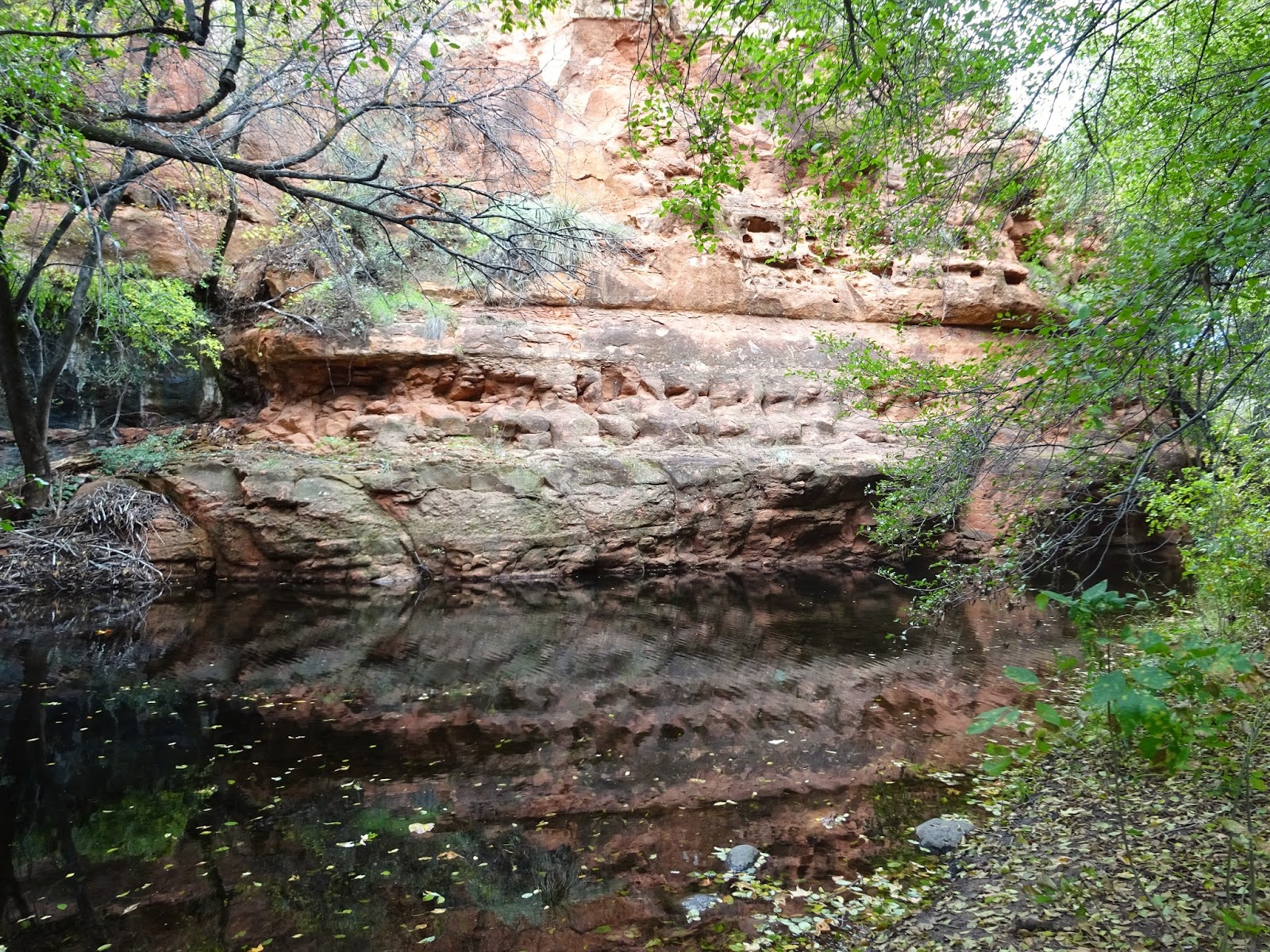
Red rock reflections in the creek.

Petroglyph covered lava rock fallen from the mountain top high above.


We were fortunate to overlap briefly with Steve and Mona Liza so we met up for dinner at Pizzeria Bocce in Cottonwood, AZ. It was terrific fun to catch up since we last saw them in Denver in May and we planned a hike that I'll share in a future post.

A little blurry but it sure was good to get together once again!
Steve, Mona Liza, Hans, Lisa.

The last thing we did before moving on down the road was to visit another Native American heritage site: V Bar V. V Bar V is the largest known petroglyph site in the Verde Valley and is named after the former ranch property where it is located. The site has been identified as the Beaver Creek Rock Art Style and was created by the Southern Sinagua Indians between AD 1150 and 1400.

This was the most protected rock art site we have ever visited. We walked down a one third mile trail to a fenced in area guarded by a ranger host. The only graffiti added to the site were a couple of names etched into the rock in the 1800's.

We saw several small tarantulas, it must be breeding season!

An interpretive host described how certain images denoted planting and harvesting times based on when the sun peaked through the rocks at various times of the year. I don't know how they figured that out based on the multiple layers of images placed here over hundreds of years!

We've not seen birds like these at any other sites in our travels.


Fall colors are just starting to show here in AZ.

Next we move on to Sedona for a few days...


Wednesday, October 28, 2015

Just a Small Taste of Bluff, UT

Bluff is a tiny south eastern Utah town in the San Juan River valley founded in 1880 by 70 Mormon families. These families had spent the previous winter making a harrowing 250 mile journey from Parowan, UT to the San Juan River valley, overcoming enormous obstacles in order to answer their calling. We learned their story, from their descendants, at the Bluff Fort Historic Site.

Hans and I first heard of Bluff from our friends John and Pam, who have visited twice and rave about the fascinating hiking among ancient ruins in this area. Before the Mormons arrived, the area was inhabited for hundreds of years by Native Americans and the remains of their home sites can be found in numerous canyons all across south eastern Utah.

We only had two nights in Bluff, but that gave us one full day to get a feel for the area and gain an appreciation for the endless opportunities for exploration around here. One can drive a lot of miles seeking ancient ruins in Utah but we chose to stick close to town and explored the Butler Wash area immediately east of Comb Ridge.

Comb Ridge is a huge monocline running 80 miles from Kayenta in northern AZ to the Abajo mountains near Blanding, UT. The west side of the Ridge is a sheer cliff but the east side is split by numerous box canyons, some with flowing springs...perfect habitat for ancient peoples to thrive.

Butler Wash road is a decent dirt road with a number of known Native American sites to explore, but you need details to find them...details such as exact mileage to the trail head. Once you arrive at that exact location there are no signs saying you've reached the location of a particular site, there might be a single fiberglass trail sign without any specific details. We used this link to find the three sites we visited, but a detailed book about the area would be much better.

We visited the Wolfman Petroglyph Panel, Monarch Cave Ruins and what we thought would be Split Level Ruins but turned out to be some other minor ruins. We learned that the canyons are full of dense foliage and long pants would be ideal for future explorations of the area, there can be lots of bushwacking! It is easy to see that we could pick a different canyon or two every day and work our way up Butler Wash Road...and that is just one small part of a huge area full of ancient ruins to find!

View up Butler Wash with Comb Ridge on the left.

Ancient ruins in the wall of Butler Wash near the Wolfman Petroglyph Panel.


We scrambled along the edge of the wash wall to reach the Wolfman Panel.
We saw very few people on Butler Wash Road, this site is closest to the highway so it gets the most visitors.

The Wolfman?

These are thought to be made by Basketmaker Anasazi.


Moving on down the road we came to what we hoped was the Monarch Cave Ruins trail. We were happy to see a trail sign, even though it had no site information, and an actual trail. The foliage was dense as we made our way into the canyon.

No details, just a trail marker, it'll lead us to something...

At the head of the box canyon we found Monarch Cave Ruins!


Looking back up the canyon from the site.

There were lots of pot sherds, corn cobs, grinding holes and metates.

Most of the pictographs were hand prints.

Next we drove to what we thought would be Split Level Ruins trail. We had a trail marker and a trail to follow, though it did not lead us to the expected ruins. Not a problem, the walk was beautiful and it was fun to explore a canyon not knowing what you might see around each turn!

Heading towards Comb Ridge.

Very dilapidated ruins.


It was a gorgeous day for exploring.

We stayed at Cottonwood RV Park in Bluff. It's a nice little park that was nearing the end of its season, with only a handful of sites taken. Full hookups and a picnic table at each site. We had okay 4G Verizon signal with our booster, the parks wifi was useless.


Much time can be spent in this corner of Utah searching for ruins among the dramatic landscapes. In the future we'd likely hop around to different areas such as Bluff and Blanding and Cortez, CO, spending a little time in each exploring. A high clearance or 4x4 vehicle is needed to really get into the back country around here.

Next up: a brief stopover in Flagstaff.